Mueang Yang geodata
Mueang Yang (Nakhon Ratchasima) is a seat of a second-order administrative division; located in Thailand in Asia/Bangkok (GMT+7) time zone. In our database, there are 331 cities with bigger population. Compared to other cities in Thailand, 57.3% of cities are located further ↓South; 77.8% of cities are located further ←West and 58.5% of cities have lower elevation than Mueang Yang. Note1


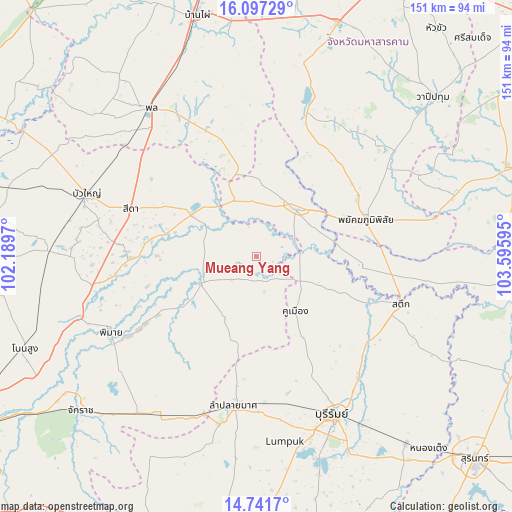
Mueang Yang GPS coordinates[2]
15° 25' 14.16" North, 102° 53' 34.152" East
| Map corner | latitude | longitude |
|---|---|---|
| Upper-left | 16.09729°, | 102.1897° |
| Center: | 15.4206°, | 102.89282° |
| Lower-right: | 14.7417°, | 103.59595° |
| Map W x H: | 150.7×150.7 km | = 93.6×93.6mi |
| max Lat: | 20.43353° ⇑42.7% North |
| Mueang Yang: | 15.4206° |
| min Lat: | ⇓57.3% South 5.77434° |
| min Long | Mueang Yang | max Long |
| 97.93288° | 102.89282° | 105.49506° |
| W 77.8%⇐ | ⇒22.2% E |
Elevation
Elevation of Mueang Yang is 145 m = 476 ft, and this is 19.5 m = 64 ft above average elevation for this country.
| Max E: |
1011 m = 3317 ft | 41.5% |
| Mueang Yang | 145 m 476 ft | |
| Avg. | 125.5 m = 412 ft | |
Min E: |
1 m = 3 ft | 58.5% |
See also: Thailand elevation on elevation.city.
Geographical zone
Mueang Yang is located in North Torrid zone (between Equator and Tropic of Cancer). Distance of this Northern Tropic circle is 891.3 km =553.8 mi to North.| Distance of | km | miles | from Mueang Yang |
|---|---|---|---|
| North Pole | 8292.5 | 5152.7 | to North |
| Arctic Circle | 5686.6 | 3533.5 | to North |
| Tropic Cancer | 891.3 | 553.8 | to North |
| Equator | 1714.6 | 1065.4 | to South |


Nearby cities:
15 places around Mueang Yang: (largest is in red/bold)
• Ban Mai Chaiyaphot
18.2 km =11.3 mi,  339°
339°
• Chum Phuang
18.1 km =11.2 mi,  243°
243°
• Khaen Dong
27.9 km =17.3 mi,  112°
112°
• Khu Mueang
20.3 km =12.6 mi,  144°
144°
• Lam Plai Mat
44.3 km =27.5 mi,  187°
187°
• Lam Thamen Chai
7.9 km =4.9 mi,  160°
160°
• Na Chueak
44 km =27.3 mi,  19°
19°
• Na Pho
25.4 km =15.8 mi, 15°
• Non Daeng
37.8 km =23.5 mi,  268°
268°
• Phayakkhaphum Phisai
34 km =21.1 mi,  71°
71°
• Phutthaisong
20 km =12.4 mi,  44°
44°
• Prathai
22.1 km =13.7 mi,  304°
304°
• Satuek
44.9 km =27.9 mi, 107°
• Sida
37.8 km =23.5 mi,  292°
292°
• Yang Si Surat
36.9 km =22.9 mi, 37°
Sources, notices
• [Note1] Compared only with cities in Thailand existing in our database
• [Src1] Map data: © OpenStreetMap contributors (CC-BY-SA)
• [Src2] Other city data from geonames.org with taken over terms of usage.
• [Src3] Geographical zone / Annual Mean Temperature by Robert A. Rohde @ Wikipedia
