Phayakkhaphum Phisai geodata
Phayakkhaphum Phisai (Maha Sarakham) is a seat of a second-order administrative division; located in Thailand in Asia/Bangkok (GMT+7) time zone. With population of 10,212 people, there are 281 cities with bigger population in this country. Compared to other cities in Thailand, 58.4% of cities are located further ↓South; 81.6% of cities are located further ←West and 56% of cities have lower elevation than Phayakkhaphum Phisai. Note1


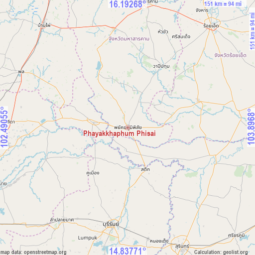
Phayakkhaphum Phisai GPS coordinates[2]
15° 30' 58.716" North, 103° 11' 37.212" East
| Map corner | latitude | longitude |
|---|---|---|
| Upper-left | 16.19268°, | 102.49055° |
| Center: | 15.51631°, | 103.19367° |
| Lower-right: | 14.83771°, | 103.8968° |
| Map W x H: | 150.7×150.7 km | = 93.6×93.6mi |
| max Lat: | 20.43353° ⇑41.6% North |
| Phayakkhaphum Phisai: | 15.51631° |
| min Lat: | ⇓58.4% South 5.77434° |
| min Long | Phayakkhaphum P | max Long |
| 97.93288° | 103.19367° | 105.49506° |
| W 81.6%⇐ | ⇒18.4% E |
Elevation
Elevation of Phayakkhaphum Phisai is 139 m = 456 ft, and this is 13.5 m = 44 ft above average elevation for this country.
| Max E: |
1011 m = 3317 ft | 44% |
| Phayakkhaphum Phisai | 139 m 456 ft | |
| Avg. | 125.5 m = 412 ft | |
Min E: |
1 m = 3 ft | 56% |
See also: Thailand elevation on elevation.city.
Geographical zone
Phayakkhaphum Phisai is located in North Torrid zone (between Equator and Tropic of Cancer). Distance of this Northern Tropic circle is 880.7 km =547.2 mi to North.| Distance of | km | miles | from Phayakkhaphum Phisai |
|---|---|---|---|
| North Pole | 8281.8 | 5146.1 | to North |
| Arctic Circle | 5675.9 | 3526.8 | to North |
| Tropic Cancer | 880.7 | 547.2 | to North |
| Equator | 1725.3 | 1072.1 | to South |


Nearby cities:
15 places around Phayakkhaphum Phisai: (largest is in red/bold)
• Ban Mai Chaiyaphot
39.1 km =24.3 mi,  279°
279°
• Chumphon Buri
28.3 km =17.6 mi,  131°
131°
• Kaset Wisai
44.5 km =27.7 mi,  69°
69°
• Khaen Dong
22.3 km =13.9 mi,  196°
196°
• Khu Mueang
34.1 km =21.2 mi,  217°
217°
• Lam Thamen Chai
34.6 km =21.5 mi,  238°
238°
• Mueang Yang
34 km =21.1 mi,  251°
251°
• Na Chueak
35.3 km =21.9 mi,  330°
330°
• Na Dun
22.6 km =14 mi,  9°
9°
• Na Pho
29.1 km =18.1 mi,  298°
298°
• Pathum Rat
20.7 km =12.9 mi,  50°
50°
• Phutthaisong
18.4 km =11.4 mi, 280°
• Satuek
26.6 km =16.5 mi,  156°
156°
• Wapi Pathum
41.5 km =25.8 mi,  28°
28°
• Yang Si Surat
21 km =13 mi, 332°
Sources, notices
• [Note1] Compared only with cities in Thailand existing in our database
• [Src1] Map data: © OpenStreetMap contributors (CC-BY-SA)
• [Src2] Other city data from geonames.org with taken over terms of usage.
• [Src3] Geographical zone / Annual Mean Temperature by Robert A. Rohde @ Wikipedia
