Siao geodata
Siao (Sisaket) is a seat of a second-order administrative division; located in Thailand in Asia/Bangkok (GMT+7) time zone. In our database, there are 331 cities with bigger population. Compared to other cities in Thailand, 53.3% of cities are located further ↑North; 96.5% of cities are located further ←West and 58.1% of cities have lower elevation than Siao. Note1


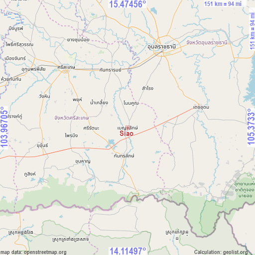
Siao GPS coordinates[2]
14° 47' 44.988" North, 104° 40' 12.612" East
| Map corner | latitude | longitude |
|---|---|---|
| Upper-left | 15.47456°, | 103.96705° |
| Center: | 14.79583°, | 104.67017° |
| Lower-right: | 14.11497°, | 105.3733° |
| Map W x H: | 151.2×151.2 km | = 94×94mi |
| max Lat: | 20.43353° ⇑53.3% North |
| Siao: | 14.79583° |
| min Lat: | ⇓46.7% South 5.77434° |
| min Long | Siao | max Long |
| 97.93288° | 104.67017° | 105.49506° |
| W 96.5%⇐ | ⇒3.5% E |
Elevation
Elevation of Siao is 144 m = 472 ft, and this is 18.5 m = 61 ft above average elevation for this country.
| Max E: |
1011 m = 3317 ft | 41.9% |
| Siao | 144 m 472 ft | |
| Avg. | 125.5 m = 412 ft | |
Min E: |
1 m = 3 ft | 58.1% |
See also: Thailand elevation on elevation.city.
Geographical zone
Siao is located in North Torrid zone (between Equator and Tropic of Cancer). Distance of this Northern Tropic circle is 960.8 km =597 mi to North.| Distance of | km | miles | from Siao |
|---|---|---|---|
| North Pole | 8361.9 | 5195.8 | to North |
| Arctic Circle | 5756 | 3576.6 | to North |
| Tropic Cancer | 960.8 | 597 | to North |
| Equator | 1645.1 | 1022.2 | to South |


Nearby cities:
15 places around Siao: (largest is in red/bold)
• Det Udom
45.5 km =28.3 mi,  74°
74°
• Kantharalak
17.4 km =10.8 mi,  187°
187°
• Kanthararom
35.7 km =22.2 mi,  343°
343°
• Khun Han
33 km =20.5 mi,  233°
233°
• Nam Khun
36.1 km =22.4 mi,  130°
130°
• Nam Kliang
22.3 km =13.9 mi,  310°
310°
• Non Kho
14.7 km =9.1 mi,  23°
23°
• Phayu
32.5 km =20.2 mi,  292°
292°
• Phrai Bueng
33.5 km =20.8 mi,  260°
260°
• Samrong
26.6 km =16.5 mi,  27°
27°
• Si Rattana
21.6 km =13.4 mi,  269°
269°
• Si Sa Ket
51 km =31.7 mi, 314°
• Thung Si Udom
26.6 km =16.5 mi,  105°
105°
• Wang Hin
50.1 km =31.1 mi, 289°
• Warin Chamrap
48.8 km =30.3 mi, 25°
Sources, notices
• [Note1] Compared only with cities in Thailand existing in our database
• [Src1] Map data: © OpenStreetMap contributors (CC-BY-SA)
• [Src2] Other city data from geonames.org with taken over terms of usage.
• [Src3] Geographical zone / Annual Mean Temperature by Robert A. Rohde @ Wikipedia
