Det Udom geodata
Det Udom (Changwat Ubon Ratchathani) is a seat of a second-order administrative division; located in Thailand in Asia/Bangkok (GMT+7) time zone. With population of 35,669 people, there are 89 cities with bigger population in this country. Compared to other cities in Thailand, 51.5% of cities are located further ↑North; 98.9% of cities are located further ←West and 55.4% of cities have lower elevation than Det Udom. Note1


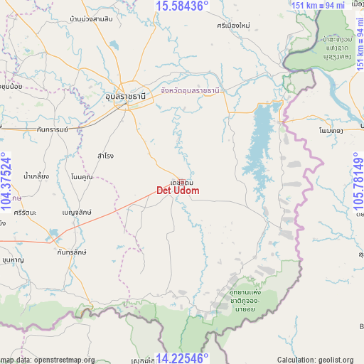
Det Udom GPS coordinates[2]
14° 54' 21.528" North, 105° 4' 42.096" East
| Map corner | latitude | longitude |
|---|---|---|
| Upper-left | 15.58436°, | 104.37524° |
| Center: | 14.90598°, | 105.07836° |
| Lower-right: | 14.22546°, | 105.78149° |
| Map W x H: | 151.1×151.1 km | = 93.9×93.9mi |
| max Lat: | 20.43353° ⇑51.5% North |
| Det Udom: | 14.90598° |
| min Lat: | ⇓48.5% South 5.77434° |
| min Long | Det Udom | max Long |
| 97.93288° | 105.07836° | 105.49506° |
| W 98.9%⇐ | ⇒1.1% E |
Elevation
Elevation of Det Udom is 137 m = 449 ft, and this is 11.5 m = 38 ft above average elevation for this country.
| Max E: |
1011 m = 3317 ft | 44.6% |
| Det Udom | 137 m 449 ft | |
| Avg. | 125.5 m = 412 ft | |
Min E: |
1 m = 3 ft | 55.4% |
See also: Thailand elevation on elevation.city.
Geographical zone
Det Udom is located in North Torrid zone (between Equator and Tropic of Cancer). Distance of this Northern Tropic circle is 948.5 km =589.4 mi to North.| Distance of | km | miles | from Det Udom |
|---|---|---|---|
| North Pole | 8349.7 | 5188.3 | to North |
| Arctic Circle | 5743.8 | 3569 | to North |
| Tropic Cancer | 948.5 | 589.4 | to North |
| Equator | 1657.4 | 1029.9 | to South |


Nearby cities:
15 places around Det Udom: (largest is in red/bold)
• Benchalak
45.5 km =28.3 mi,  254°
254°
• Buntharik
39.5 km =24.5 mi,  114°
114°
• Na Chaluai
46.5 km =28.9 mi,  157°
157°
• Na Yia
17.6 km =10.9 mi,  353°
353°
• Nam Khun
39.4 km =24.5 mi,  204°
204°
• Non Kho
38 km =23.6 mi,  271°
271°
• Phibun Mangsahan
41 km =25.5 mi,  23°
23°
• Samrong
33.6 km =20.9 mi,  289°
289°
• Sawang Wirawong
37.3 km =23.2 mi,  2°
2°
• Siao
45.5 km =28.3 mi, 254°
• Sirindhorn
47 km =29.2 mi,  45°
45°
• Tan Sum
46.3 km =28.8 mi,  10°
10°
• Thung Si Udom
26.5 km =16.5 mi,  223°
223°
• Ubon Ratchathani
44.4 km =27.6 mi,  326°
326°
• Warin Chamrap
39.4 km =24.5 mi,  324°
324°
Sources, notices
• [Note1] Compared only with cities in Thailand existing in our database
• [Src1] Map data: © OpenStreetMap contributors (CC-BY-SA)
• [Src2] Other city data from geonames.org with taken over terms of usage.
• [Src3] Geographical zone / Annual Mean Temperature by Robert A. Rohde @ Wikipedia
