Tao Ngoi geodata
Tao Ngoi (Sakon Nakhon) is a seat of a second-order administrative division; located in Thailand in Asia/Bangkok (GMT+7) time zone. In our database, there are 331 cities with bigger population. Compared to other cities in Thailand, 78.3% of cities are located further ↓South; 92.5% of cities are located further ←West and 75.5% of cities have lower elevation than Tao Ngoi. Note1


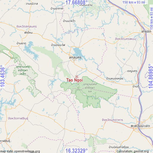
Tao Ngoi GPS coordinates[2]
16° 59' 48.804" North, 104° 10' 0.192" East
| Map corner | latitude | longitude |
|---|---|---|
| Upper-left | 17.66808°, | 103.4636° |
| Center: | 16.99689°, | 104.16672° |
| Lower-right: | 16.32329°, | 104.86985° |
| Map W x H: | 149.5×149.5 km | = 92.9×92.9mi |
| max Lat: | 20.43353° ⇑21.7% North |
| Tao Ngoi: | 16.99689° |
| min Lat: | ⇓78.3% South 5.77434° |
| min Long | Tao Ngoi | max Long |
| 97.93288° | 104.16672° | 105.49506° |
| W 92.5%⇐ | ⇒7.5% E |
Elevation
Elevation of Tao Ngoi is 183 m = 600 ft, and this is 57.5 m = 189 ft above average elevation for this country.
| Max E: |
1011 m = 3317 ft | 24.5% |
| Tao Ngoi | 183 m 600 ft | |
| Avg. | 125.5 m = 412 ft | |
Min E: |
1 m = 3 ft | 75.5% |
See also: Thailand elevation on elevation.city.
Geographical zone
Tao Ngoi is located in North Torrid zone (between Equator and Tropic of Cancer). Distance of this Northern Tropic circle is 716 km =444.9 mi to North.| Distance of | km | miles | from Tao Ngoi |
|---|---|---|---|
| North Pole | 8117.2 | 5043.8 | to North |
| Arctic Circle | 5511.3 | 3424.6 | to North |
| Tropic Cancer | 716 | 444.9 | to North |
| Equator | 1889.9 | 1174.3 | to South |


Nearby cities:
15 places around Tao Ngoi: (largest is in red/bold)
• Dong Luang
44.3 km =27.5 mi,  116°
116°
• Huai Phueng
47.2 km =29.3 mi,  215°
215°
• Khao Wong
34 km =21.1 mi,  193°
193°
• Khok Si Suphan
12.8 km =8 mi,  65°
65°
• Kusuman
41.2 km =25.6 mi,  25°
25°
• Kut Bak
38.4 km =23.9 mi,  285°
285°
• Na Kae
36 km =22.4 mi,  98°
98°
• Na Khu
29.9 km =18.6 mi,  209°
209°
• Nikhom Nam Un
52 km =32.3 mi, 293°
• Phanna Nikhom
51.9 km =32.2 mi,  319°
319°
• Phon Na Kaeo
28.2 km =17.5 mi, 27°
• Phu Phan
20.5 km =12.7 mi,  270°
270°
• Pla Pak
43.3 km =26.9 mi,  61°
61°
• Sakon Nakhon
18.4 km =11.4 mi,  353°
353°
• Wang Yang
31.2 km =19.4 mi,  77°
77°
Sources, notices
• [Note1] Compared only with cities in Thailand existing in our database
• [Src1] Map data: © OpenStreetMap contributors (CC-BY-SA)
• [Src2] Other city data from geonames.org with taken over terms of usage.
• [Src3] Geographical zone / Annual Mean Temperature by Robert A. Rohde @ Wikipedia
