Na Khu geodata
Na Khu (Kalasin) is a seat of a second-order administrative division; located in Thailand in Asia/Bangkok (GMT+7) time zone. In our database, there are 331 cities with bigger population. Compared to other cities in Thailand, 75.6% of cities are located further ↓South; 90.5% of cities are located further ←West and 78.5% of cities have lower elevation than Na Khu. Note1


Na Khu GPS coordinates[2]
16° 45' 49.824" North, 104° 1' 34.536" East
| Map corner | latitude | longitude |
|---|---|---|
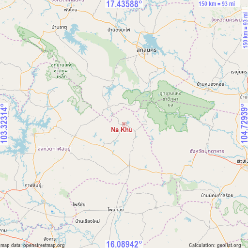
| Upper-left | 17.43588°, | 103.32314° |
| Center: | 16.76384°, | 104.02626° |
| Lower-right: | 16.08942°, | 104.72939° |
| Map W x H: | 149.7×149.7 km | = 93×93mi |
| max Lat: | 20.43353° ⇑24.4% North |
| Na Khu: | 16.76384° |
| min Lat: | ⇓75.6% South 5.77434° |
| min Long | Na Khu | max Long |
| 97.93288° | 104.02626° | 105.49506° |
| W 90.5%⇐ | ⇒9.5% E |
Elevation
Elevation of Na Khu is 192 m = 630 ft, and this is 66.5 m = 218 ft above average elevation for this country.
| Max E: |
1011 m = 3317 ft | 21.5% |
| Na Khu | 192 m 630 ft | |
| Avg. | 125.5 m = 412 ft | |
Min E: |
1 m = 3 ft | 78.5% |
See also: Thailand elevation on elevation.city.
Geographical zone
Na Khu is located in North Torrid zone (between Equator and Tropic of Cancer). Distance of this Northern Tropic circle is 742 km =461.1 mi to North.| Distance of | km | miles | from Na Khu |
|---|---|---|---|
| North Pole | 8143.1 | 5059.9 | to North |
| Arctic Circle | 5537.2 | 3440.7 | to North |
| Tropic Cancer | 742 | 461.1 | to North |
| Equator | 1864 | 1158.2 | to South |


Nearby cities:
15 places around Na Khu: (largest is in red/bold)
• Don Chan
49 km =30.4 mi,  225°
225°
• Huai Phueng
17.7 km =11 mi,  224°
224°
• Kham Muang
45.5 km =28.3 mi,  293°
293°
• Khamcha-i
46.7 km =29 mi,  116°
116°
• Khao Wong
9.8 km =6.1 mi,  136°
136°
• Khok Si Suphan
41 km =25.5 mi,  40°
40°
• Kuchinarai
24.9 km =15.5 mi,  174°
174°
• Kut Bak
42.3 km =26.3 mi,  328°
328°
• Moeiwadi
43.9 km =27.3 mi,  161°
161°
• Na Mon
32.9 km =20.4 mi, 230°
• Nong Sung
46.3 km =28.8 mi,  132°
132°
• Phu Phan
26.7 km =16.6 mi,  347°
347°
• Sakon Nakhon
46 km =28.6 mi,  16°
16°
• Somdet
30.2 km =18.8 mi,  257°
257°
• Tao Ngoi
29.9 km =18.6 mi,  29°
29°
Sources, notices
• [Note1] Compared only with cities in Thailand existing in our database
• [Src1] Map data: © OpenStreetMap contributors (CC-BY-SA)
• [Src2] Other city data from geonames.org with taken over terms of usage.
• [Src3] Geographical zone / Annual Mean Temperature by Robert A. Rohde @ Wikipedia
