Khok Si Suphan geodata
Khok Si Suphan (Sakon Nakhon) is a seat of a second-order administrative division; located in Thailand in Asia/Bangkok (GMT+7) time zone. In our database, there are 331 cities with bigger population. Compared to other cities in Thailand, 79% of cities are located further ↓South; 93.3% of cities are located further ←West and 71.1% of cities have lower elevation than Khok Si Suphan. Note1


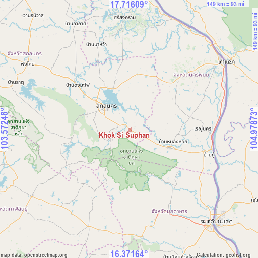
Khok Si Suphan GPS coordinates[2]
17° 2' 42.252" North, 104° 16' 32.16" East
| Map corner | latitude | longitude |
|---|---|---|
| Upper-left | 17.71609°, | 103.57248° |
| Center: | 17.04507°, | 104.2756° |
| Lower-right: | 16.37164°, | 104.97873° |
| Map W x H: | 149.5×149.5 km | = 92.9×92.9mi |
| max Lat: | 20.43353° ⇑21% North |
| Khok Si Suphan: | 17.04507° |
| min Lat: | ⇓79% South 5.77434° |
| min Long | Khok Si Suphan | max Long |
| 97.93288° | 104.2756° | 105.49506° |
| W 93.3%⇐ | ⇒6.7% E |
Elevation
Elevation of Khok Si Suphan is 172 m = 564 ft, and this is 46.5 m = 153 ft above average elevation for this country.
| Max E: |
1011 m = 3317 ft | 28.9% |
| Khok Si Suphan | 172 m 564 ft | |
| Avg. | 125.5 m = 412 ft | |
Min E: |
1 m = 3 ft | 71.1% |
See also: Thailand elevation on elevation.city.
Geographical zone
Khok Si Suphan is located in North Torrid zone (between Equator and Tropic of Cancer). Distance of this Northern Tropic circle is 710.7 km =441.6 mi to North.| Distance of | km | miles | from Khok Si Suphan |
|---|---|---|---|
| North Pole | 8111.8 | 5040.4 | to North |
| Arctic Circle | 5505.9 | 3421.2 | to North |
| Tropic Cancer | 710.7 | 441.6 | to North |
| Equator | 1895.2 | 1177.6 | to South |


Nearby cities:
15 places around Khok Si Suphan: (largest is in red/bold)
• Dong Luang
37.8 km =23.5 mi,  132°
132°
• Khao Wong
43.1 km =26.8 mi,  207°
207°
• Kusuman
32.5 km =20.2 mi,  10°
10°
• Kut Bak
48.8 km =30.3 mi,  275°
275°
• Na Kae
26.3 km =16.3 mi,  114°
114°
• Na Khu
41 km =25.5 mi,  220°
220°
• Na Wa
52.8 km =32.8 mi,  339°
339°
• Phon Na Kaeo
19.6 km =12.2 mi,  4°
4°
• Phu Phan
32.5 km =20.2 mi,  260°
260°
• Pla Pak
30.6 km =19 mi,  60°
60°
• Renu Nakhon
42.7 km =26.5 mi,  89°
89°
• Sakon Nakhon
18.8 km =11.7 mi,  313°
313°
• Tao Ngoi
12.8 km =8 mi,  245°
245°
• That Phanom
47.8 km =29.7 mi,  104°
104°
• Wang Yang
18.9 km =11.7 mi, 85°
Sources, notices
• [Note1] Compared only with cities in Thailand existing in our database
• [Src1] Map data: © OpenStreetMap contributors (CC-BY-SA)
• [Src2] Other city data from geonames.org with taken over terms of usage.
• [Src3] Geographical zone / Annual Mean Temperature by Robert A. Rohde @ Wikipedia
