Na Kae geodata
Na Kae (Nakhon Phanom) is a seat of a second-order administrative division; located in Thailand in Asia/Bangkok (GMT+7) time zone. In our database, there are 331 cities with bigger population. Compared to other cities in Thailand, 77.5% of cities are located further ↓South; 95.2% of cities are located further ←West and 62% of cities have lower elevation than Na Kae. Note1


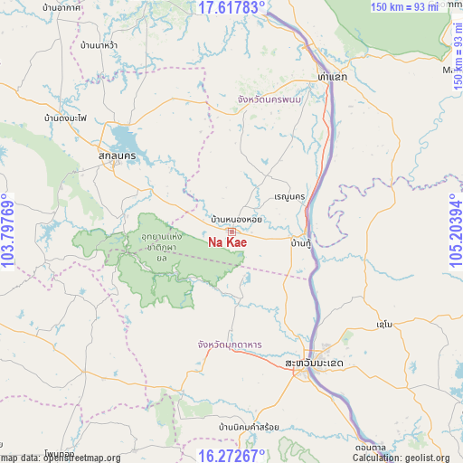
Na Kae GPS coordinates[2]
16° 56' 47.22" North, 104° 30' 2.916" East
| Map corner | latitude | longitude |
|---|---|---|
| Upper-left | 17.61783°, | 103.79769° |
| Center: | 16.94645°, | 104.50081° |
| Lower-right: | 16.27267°, | 105.20394° |
| Map W x H: | 149.6×149.6 km | = 93×93mi |
| max Lat: | 20.43353° ⇑22.5% North |
| Na Kae: | 16.94645° |
| min Lat: | ⇓77.5% South 5.77434° |
| min Long | Na Kae | max Long |
| 97.93288° | 104.50081° | 105.49506° |
| W 95.2%⇐ | ⇒4.8% E |
Elevation
Elevation of Na Kae is 153 m = 502 ft, and this is 27.5 m = 90 ft above average elevation for this country.
| Max E: |
1011 m = 3317 ft | 38% |
| Na Kae | 153 m 502 ft | |
| Avg. | 125.5 m = 412 ft | |
Min E: |
1 m = 3 ft | 62% |
See also: Thailand elevation on elevation.city.
Geographical zone
Na Kae is located in North Torrid zone (between Equator and Tropic of Cancer). Distance of this Northern Tropic circle is 721.7 km =448.4 mi to North.| Distance of | km | miles | from Na Kae |
|---|---|---|---|
| North Pole | 8122.8 | 5047.3 | to North |
| Arctic Circle | 5516.9 | 3428 | to North |
| Tropic Cancer | 721.7 | 448.4 | to North |
| Equator | 1884.3 | 1170.8 | to South |


Nearby cities:
15 places around Na Kae: (largest is in red/bold)
• Dong Luang
15 km =9.3 mi,  164°
164°
• Khamcha-i
41.9 km =26 mi,  191°
191°
• Khao Wong
51.6 km =32.1 mi,  237°
237°
• Khok Si Suphan
26.3 km =16.3 mi,  294°
294°
• Kusuman
46.6 km =29 mi,  337°
337°
• Mukdahan
50.5 km =31.4 mi,  152°
152°
• Nong Sung
54.1 km =33.6 mi,  197°
197°
• Phon Na Kaeo
37.9 km =23.5 mi,  323°
323°
• Pla Pak
26.2 km =16.3 mi,  5°
5°
• Renu Nakhon
22.1 km =13.7 mi,  58°
58°
• Sakon Nakhon
44.5 km =27.7 mi,  302°
302°
• Tao Ngoi
36 km =22.4 mi,  278°
278°
• That Phanom
22.3 km =13.9 mi,  92°
92°
• Wan Yai
35.7 km =22.2 mi,  134°
134°
• Wang Yang
13.3 km =8.3 mi, 337°
Sources, notices
• [Note1] Compared only with cities in Thailand existing in our database
• [Src1] Map data: © OpenStreetMap contributors (CC-BY-SA)
• [Src2] Other city data from geonames.org with taken over terms of usage.
• [Src3] Geographical zone / Annual Mean Temperature by Robert A. Rohde @ Wikipedia
