Khao Wong geodata
Khao Wong (Kalasin) is a seat of a second-order administrative division; located in Thailand in Asia/Bangkok (GMT+7) time zone. With population of 15,184 people, there are 216 cities with bigger population in this country. Compared to other cities in Thailand, 74.6% of cities are located further ↓South; 91.4% of cities are located further ←West and 79.2% of cities have lower elevation than Khao Wong. Note1


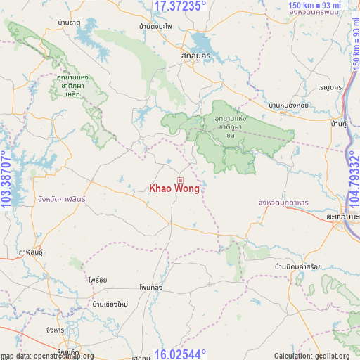
Khao Wong GPS coordinates[2]
16° 42' 0.288" North, 104° 5' 24.684" East
| Map corner | latitude | longitude |
|---|---|---|
| Upper-left | 17.37235°, | 103.38707° |
| Center: | 16.70008°, | 104.09019° |
| Lower-right: | 16.02544°, | 104.79332° |
| Map W x H: | 149.8×149.8 km | = 93.1×93.1mi |
| max Lat: | 20.43353° ⇑25.4% North |
| Khao Wong: | 16.70008° |
| min Lat: | ⇓74.6% South 5.77434° |
| min Long | Khao Wong | max Long |
| 97.93288° | 104.09019° | 105.49506° |
| W 91.4%⇐ | ⇒8.6% E |
Elevation
Elevation of Khao Wong is 194 m = 636 ft, and this is 68.5 m = 225 ft above average elevation for this country.
| Max E: |
1011 m = 3317 ft | 20.8% |
| Khao Wong | 194 m 636 ft | |
| Avg. | 125.5 m = 412 ft | |
Min E: |
1 m = 3 ft | 79.2% |
See also: Thailand elevation on elevation.city.
Geographical zone
Khao Wong is located in North Torrid zone (between Equator and Tropic of Cancer). Distance of this Northern Tropic circle is 749 km =465.4 mi to North.| Distance of | km | miles | from Khao Wong |
|---|---|---|---|
| North Pole | 8150.2 | 5064.3 | to North |
| Arctic Circle | 5544.3 | 3445.1 | to North |
| Tropic Cancer | 749 | 465.4 | to North |
| Equator | 1856.9 | 1153.8 | to South |


Nearby cities:
15 places around Khao Wong: (largest is in red/bold)
• Don Chan
50 km =31.1 mi,  237°
237°
• Dong Luang
49.4 km =30.7 mi,  74°
74°
• Huai Phueng
20 km =12.4 mi,  253°
253°
• Khamcha-i
37.6 km =23.4 mi,  111°
111°
• Khok Si Suphan
43.1 km =26.8 mi,  27°
27°
• Kuchinarai
18.2 km =11.3 mi,  193°
193°
• Moeiwadi
35.3 km =21.9 mi,  168°
168°
• Na Khu
9.8 km =6.1 mi,  316°
316°
• Na Mon
35.1 km =21.8 mi, 246°
• Nong Phok
45 km =28 mi,  164°
164°
• Nong Sung
36.5 km =22.7 mi,  131°
131°
• Phu Phan
35.5 km =22.1 mi,  339°
339°
• Somdet
36.3 km =22.6 mi,  270°
270°
• Tao Ngoi
34 km =21.1 mi,  13°
13°
• Waeng
46.1 km =28.6 mi,  195°
195°
Sources, notices
• [Note1] Compared only with cities in Thailand existing in our database
• [Src1] Map data: © OpenStreetMap contributors (CC-BY-SA)
• [Src2] Other city data from geonames.org with taken over terms of usage.
• [Src3] Geographical zone / Annual Mean Temperature by Robert A. Rohde @ Wikipedia
