Sapphaya geodata
Sapphaya (Chai Nat) is a seat of a second-order administrative division; located in Thailand in Asia/Bangkok (GMT+7) time zone. In our database, there are 331 cities with bigger population. Compared to other cities in Thailand, 52% of cities are located further ↓South; 66% of cities are located further →East and 72.9% of cities have higher elevation than Sapphaya. Note1


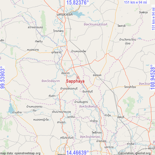
Sapphaya GPS coordinates[2]
15° 8' 46.176" North, 100° 14' 31.74" East
| Map corner | latitude | longitude |
|---|---|---|
| Upper-left | 15.82376°, | 99.53903° |
| Center: | 15.14616°, | 100.24215° |
| Lower-right: | 14.46639°, | 100.94528° |
| Map W x H: | 150.9×150.9 km | = 93.8×93.8mi |
| max Lat: | 20.43353° ⇑48% North |
| Sapphaya: | 15.14616° |
| min Lat: | ⇓52% South 5.77434° |
| min Long | Sapphaya | max Long |
| 97.93288° | 100.24215° | 105.49506° |
| W 34%⇐ | ⇒66% E |
Elevation
Elevation of Sapphaya is 17 m = 56 ft, and this is 108.5 m = 356 ft below average elevation for this country.
| Max E: |
1011 m = 3317 ft | 72.9% |
| Avg. | 125.5 m = 412 ft | |
| Sapphaya | 17 m = 56 ft | |
Min E: |
1 m = 3 ft | 27.1% |
See also: Thailand elevation on elevation.city.
Geographical zone
Sapphaya is located in North Torrid zone (between Equator and Tropic of Cancer). Distance of this Northern Tropic circle is 921.8 km =572.8 mi to North.| Distance of | km | miles | from Sapphaya |
|---|---|---|---|
| North Pole | 8323 | 5171.7 | to North |
| Arctic Circle | 5717.1 | 3552.4 | to North |
| Tropic Cancer | 921.8 | 572.8 | to North |
| Equator | 1684.1 | 1046.5 | to South |


Nearby cities:
15 places around Sapphaya: (largest is in red/bold)
• Ban Mi
33.6 km =20.9 mi,  109°
109°
• Bang Racham
29.4 km =18.3 mi,  164°
164°
• Chai Nat
13.5 km =8.4 mi,  289°
289°
• Doem Bang Nang Buat
36 km =22.4 mi,  205°
205°
• Doembang Nangbuat
38 km =23.6 mi,  203°
203°
• Hankha
30.5 km =19 mi,  233°
233°
• In Buri
17.9 km =11.1 mi,  149°
149°
• Manorom
25 km =15.5 mi,  316°
316°
• Phayuha Khiri
36.2 km =22.5 mi,  341°
341°
• Sankhaburi
14 km =8.7 mi,  218°
218°
• Sing Buri
33.6 km =20.9 mi, 148°
• Tak Fa
35.3 km =21.9 mi,  50°
50°
• Takhli
17 km =10.6 mi,  39°
39°
• Uthai Thani
34.9 km =21.7 mi, 318°
• Wat Sing
25.1 km =15.6 mi,  300°
300°
Sources, notices
• [Note1] Compared only with cities in Thailand existing in our database
• [Src1] Map data: © OpenStreetMap contributors (CC-BY-SA)
• [Src2] Other city data from geonames.org with taken over terms of usage.
• [Src3] Geographical zone / Annual Mean Temperature by Robert A. Rohde @ Wikipedia
