Tak Fa geodata
Tak Fa (Nakhon Sawan) is a seat of a second-order administrative division; located in Thailand in Asia/Bangkok (GMT+7) time zone. In our database, there are 331 cities with bigger population. Compared to other cities in Thailand, 56.1% of cities are located further ↓South; 58.5% of cities are located further →East and 50.3% of cities have higher elevation than Tak Fa. Note1


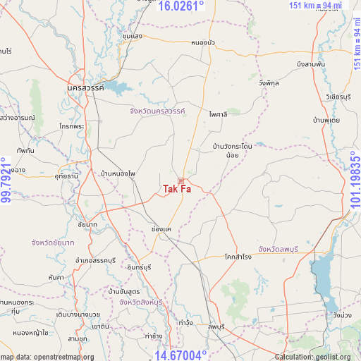
Tak Fa GPS coordinates[2]
15° 20' 57.012" North, 100° 29' 42.792" East
| Map corner | latitude | longitude |
|---|---|---|
| Upper-left | 16.0261°, | 99.7921° |
| Center: | 15.34917°, | 100.49522° |
| Lower-right: | 14.67004°, | 101.19835° |
| Map W x H: | 150.8×150.8 km | = 93.7×93.7mi |
| max Lat: | 20.43353° ⇑43.9% North |
| Tak Fa: | 15.34917° |
| min Lat: | ⇓56.1% South 5.77434° |
| min Long | Tak Fa | max Long |
| 97.93288° | 100.49522° | 105.49506° |
| W 41.5%⇐ | ⇒58.5% E |
Elevation
Elevation of Tak Fa is 91 m = 299 ft, and this is 34.5 m = 113 ft below average elevation for this country.
| Max E: |
1011 m = 3317 ft | 50.3% |
| Avg. | 125.5 m = 412 ft | |
| Tak Fa | 91 m = 299 ft | |
Min E: |
1 m = 3 ft | 49.7% |
See also: Thailand elevation on elevation.city.
Geographical zone
Tak Fa is located in North Torrid zone (between Equator and Tropic of Cancer). Distance of this Northern Tropic circle is 899.3 km =558.8 mi to North.| Distance of | km | miles | from Tak Fa |
|---|---|---|---|
| North Pole | 8300.4 | 5157.6 | to North |
| Arctic Circle | 5694.5 | 3538.4 | to North |
| Tropic Cancer | 899.3 | 558.8 | to North |
| Equator | 1706.7 | 1060.5 | to South |


Nearby cities:
15 places around Tak Fa: (largest is in red/bold)
• Ban Mi
34.2 km =21.3 mi,  172°
172°
• Chai Nat
43.8 km =27.2 mi,  245°
245°
• In Buri
42 km =26.1 mi,  205°
205°
• Khok Charoen
34.8 km =21.6 mi,  84°
84°
• Khok Samrong
39.8 km =24.7 mi,  142°
142°
• Manorom
44.4 km =27.6 mi,  264°
264°
• Nong Muang
20.7 km =12.9 mi,  123°
123°
• Phai Sali
32.4 km =20.1 mi,  30°
30°
• Phayuha Khiri
40.3 km =25 mi,  287°
287°
• Sa Bot
39.2 km =24.4 mi,  113°
113°
• Sankhaburi
49.1 km =30.5 mi,  226°
226°
• Sapphaya
35.3 km =21.9 mi, 230°
• Takhli
18.8 km =11.7 mi,  239°
239°
• Tha Tako
32.6 km =20.3 mi,  356°
356°
• Wat Sing
49.8 km =30.9 mi, 258°
Sources, notices
• [Note1] Compared only with cities in Thailand existing in our database
• [Src1] Map data: © OpenStreetMap contributors (CC-BY-SA)
• [Src2] Other city data from geonames.org with taken over terms of usage.
• [Src3] Geographical zone / Annual Mean Temperature by Robert A. Rohde @ Wikipedia
