Non Sung geodata
Non Sung (Nakhon Ratchasima) is a seat of a second-order administrative division; located in Thailand in Asia/Bangkok (GMT+7) time zone. With population of 18,399 people, there are 173 cities with bigger population in this country. Compared to other cities in Thailand, 52.3% of cities are located further ↓South; 69.8% of cities are located further ←West and 70.6% of cities have lower elevation than Non Sung. Note1


Non Sung GPS coordinates[2]
15° 10' 48.504" North, 102° 15' 25.02" East
| Map corner | latitude | longitude |
|---|---|---|
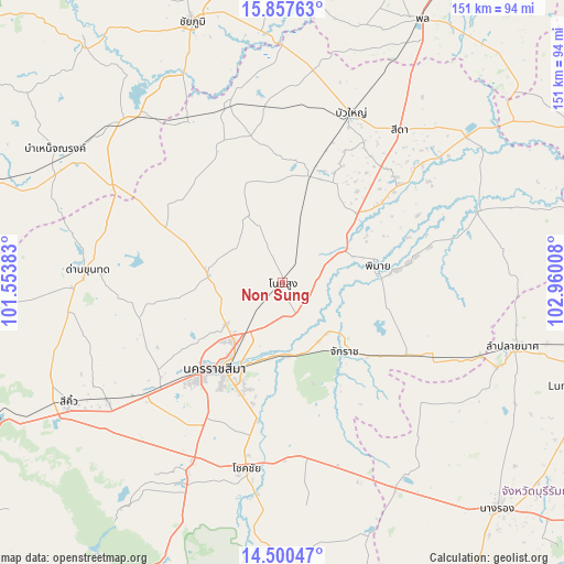
| Upper-left | 15.85763°, | 101.55383° |
| Center: | 15.18014°, | 102.25695° |
| Lower-right: | 14.50047°, | 102.96008° |
| Map W x H: | 150.9×150.9 km | = 93.8×93.8mi |
| max Lat: | 20.43353° ⇑47.7% North |
| Non Sung: | 15.18014° |
| min Lat: | ⇓52.3% South 5.77434° |
| min Long | Non Sung | max Long |
| 97.93288° | 102.25695° | 105.49506° |
| W 69.8%⇐ | ⇒30.2% E |
Elevation
Elevation of Non Sung is 170 m = 558 ft, and this is 44.5 m = 146 ft above average elevation for this country.
| Max E: |
1011 m = 3317 ft | 29.4% |
| Non Sung | 170 m 558 ft | |
| Avg. | 125.5 m = 412 ft | |
Min E: |
1 m = 3 ft | 70.6% |
See also: Thailand elevation on elevation.city.
Geographical zone
Non Sung is located in North Torrid zone (between Equator and Tropic of Cancer). Distance of this Northern Tropic circle is 918 km =570.4 mi to North.| Distance of | km | miles | from Non Sung |
|---|---|---|---|
| North Pole | 8319.2 | 5169.3 | to North |
| Arctic Circle | 5713.3 | 3550.1 | to North |
| Tropic Cancer | 918 | 570.4 | to North |
| Equator | 1687.9 | 1048.8 | to South |


Nearby cities:
15 places around Non Sung: (largest is in red/bold)
• Ban Huai Thalaeng
47.5 km =29.5 mi,  117°
117°
• Ban Lueam
49.6 km =30.8 mi,  343°
343°
• Bua Yai
48.6 km =30.2 mi,  21°
21°
• Chakkarat
25 km =15.5 mi,  137°
137°
• Chaloem Phra Kiat
19.5 km =12.1 mi,  175°
175°
• Huai Thalaeng
46.6 km =29 mi, 115°
• Kham Sakae Saeng
19.2 km =11.9 mi,  331°
331°
• Kham Thale So
41.2 km =25.6 mi,  233°
233°
• Khong
30.3 km =18.8 mi,  14°
14°
• Nakhon Ratchasima
28.6 km =17.8 mi,  215°
215°
• Non Daeng
39.7 km =24.7 mi,  49°
49°
• Non Thai
20 km =12.4 mi,  274°
274°
• Nong Bun Nak
50.4 km =31.3 mi,  166°
166°
• Phimai
26 km =16.2 mi,  79°
79°
• Phra Thong Kham
27.2 km =16.9 mi,  290°
290°
Sources, notices
• [Note1] Compared only with cities in Thailand existing in our database
• [Src1] Map data: © OpenStreetMap contributors (CC-BY-SA)
• [Src2] Other city data from geonames.org with taken over terms of usage.
• [Src3] Geographical zone / Annual Mean Temperature by Robert A. Rohde @ Wikipedia
