Khuan Kalong geodata
Khuan Kalong (Satun) is a seat of a second-order administrative division; located in Thailand in Asia/Bangkok (GMT+7) time zone. In our database, there are 331 cities with bigger population. Compared to other cities in Thailand, 95.7% of cities are located further ↑North; 70.7% of cities are located further →East and 60.5% of cities have higher elevation than Khuan Kalong. Note1


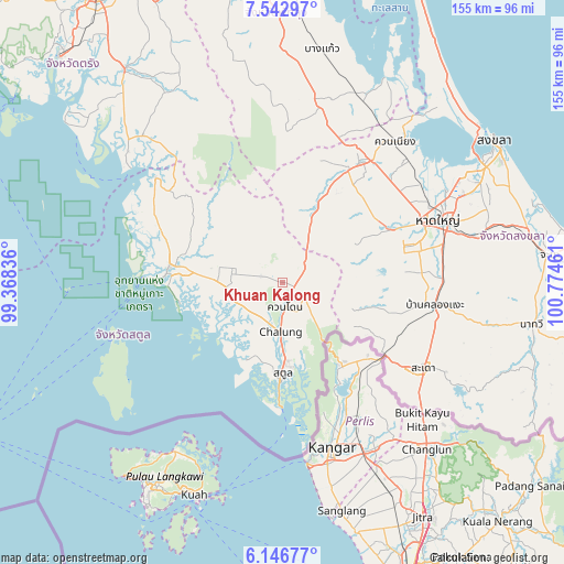
Khuan Kalong GPS coordinates[2]
6° 50' 43.368" North, 100° 4' 17.328" East
| Map corner | latitude | longitude |
|---|---|---|
| Upper-left | 7.54297°, | 99.36836° |
| Center: | 6.84538°, | 100.07148° |
| Lower-right: | 6.14677°, | 100.77461° |
| Map W x H: | 155.2×155.2 km | = 96.4×96.4mi |
| max Lat: | 20.43353° ⇑95.7% North |
| Khuan Kalong: | 6.84538° |
| min Lat: | ⇓4.3% South 5.77434° |
| min Long | Khuan Kalong | max Long |
| 97.93288° | 100.07148° | 105.49506° |
| W 29.3%⇐ | ⇒70.7% E |
Elevation
Elevation of Khuan Kalong is 43 m = 141 ft, and this is 82.5 m = 271 ft below average elevation for this country.
| Max E: |
1011 m = 3317 ft | 60.5% |
| Avg. | 125.5 m = 412 ft | |
| Khuan Kalong | 43 m = 141 ft | |
Min E: |
1 m = 3 ft | 39.5% |
See also: Thailand elevation on elevation.city.
Geographical zone
Khuan Kalong is located in North Torrid zone (between Equator and Tropic of Cancer). Distance of Equator is 761.1 km =472.9 mi to South.| Distance of | km | miles | from Khuan Kalong |
|---|---|---|---|
| North Pole | 9245.9 | 5745.1 | to North |
| Arctic Circle | 6640 | 4125.9 | to North |
| Tropic Cancer | 1844.8 | 1146.3 | to North |
| Equator | 761.1 | 472.9 | to South |


Nearby cities:
15 places around Khuan Kalong: (largest is in red/bold)
• Bang Klam
46.2 km =28.7 mi,  54°
54°
• Hat Yai
48.3 km =30 mi,  67°
67°
• Khlong Hoi Khong
35.5 km =22.1 mi,  80°
80°
• Khuan Don
6.5 km =4 mi,  173°
173°
• Khuan Niang
49.5 km =30.8 mi,  38°
38°
• La-ngu
31.6 km =19.6 mi,  278°
278°
• Manang
23.8 km =14.8 mi,  315°
315°
• Pa Bon
48.4 km =30.1 mi,  13°
13°
• Pante Malakar
50.5 km =31.4 mi,  249°
249°
• Rattaphum
38.1 km =23.7 mi,  32°
32°
• Sadao
45.1 km =28 mi,  120°
120°
• Satun
24.7 km =15.3 mi,  181°
181°
• Ta Lo Wow
47.6 km =29.6 mi, 250°
• Tha Phae
12.8 km =8 mi,  241°
241°
• Thung Wa
45.6 km =28.3 mi,  310°
310°
Sources, notices
• [Note1] Compared only with cities in Thailand existing in our database
• [Src1] Map data: © OpenStreetMap contributors (CC-BY-SA)
• [Src2] Other city data from geonames.org with taken over terms of usage.
• [Src3] Geographical zone / Annual Mean Temperature by Robert A. Rohde @ Wikipedia
