Khlong Hoi Khong geodata
Khlong Hoi Khong (Songkhla) is a seat of a second-order administrative division; located in Thailand in Asia/Bangkok (GMT+7) time zone. In our database, there are 331 cities with bigger population. Compared to other cities in Thailand, 95.2% of cities are located further ↑North; 62% of cities are located further →East and 70.6% of cities have higher elevation than Khlong Hoi Khong. Note1


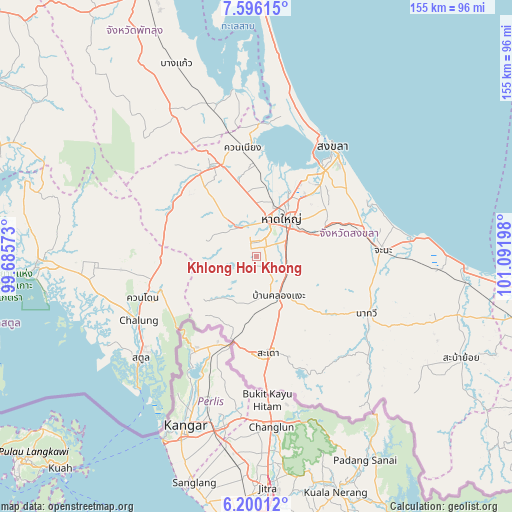
Khlong Hoi Khong GPS coordinates[2]
6° 53' 55.14" North, 100° 23' 19.86" East
| Map corner | latitude | longitude |
|---|---|---|
| Upper-left | 7.59615°, | 99.68573° |
| Center: | 6.89865°, | 100.38885° |
| Lower-right: | 6.20012°, | 101.09198° |
| Map W x H: | 155.2×155.2 km | = 96.4×96.4mi |
| max Lat: | 20.43353° ⇑95.2% North |
| Khlong Hoi Khong: | 6.89865° |
| min Lat: | ⇓4.8% South 5.77434° |
| min Long | Khlong Hoi Khon | max Long |
| 97.93288° | 100.38885° | 105.49506° |
| W 38%⇐ | ⇒62% E |
Elevation
Elevation of Khlong Hoi Khong is 21 m = 69 ft, and this is 104.5 m = 343 ft below average elevation for this country.
| Max E: |
1011 m = 3317 ft | 70.6% |
| Avg. | 125.5 m = 412 ft | |
| Khlong Hoi Khong | 21 m = 69 ft | |
Min E: |
1 m = 3 ft | 29.4% |
See also: Thailand elevation on elevation.city.
Geographical zone
Khlong Hoi Khong is located in North Torrid zone (between Equator and Tropic of Cancer). Distance of Equator is 767.1 km =476.7 mi to South.| Distance of | km | miles | from Khlong Hoi Khong |
|---|---|---|---|
| North Pole | 9240 | 5741.5 | to North |
| Arctic Circle | 6634.1 | 4122.2 | to North |
| Tropic Cancer | 1838.9 | 1142.6 | to North |
| Equator | 767.1 | 476.7 | to South |


Nearby cities:
15 places around Khlong Hoi Khong: (largest is in red/bold)
• Ban Mai
38.1 km =23.7 mi,  26°
26°
• Bang Klam
21.4 km =13.3 mi,  6°
6°
• Chana
38.8 km =24.1 mi,  87°
87°
• Hat Yai
15.6 km =9.7 mi,  38°
38°
• Khuan Don
36.5 km =22.7 mi,  250°
250°
• Khuan Kalong
35.5 km =22.1 mi,  260°
260°
• Khuan Niang
32.8 km =20.4 mi,  353°
353°
• Na Mom
19.7 km =12.2 mi,  70°
70°
• Na Thawi
37.7 km =23.4 mi,  117°
117°
• Rattaphum
30 km =18.6 mi,  330°
330°
• Sadao
29.1 km =18.1 mi,  172°
172°
• Satun
46.9 km =29.1 mi,  229°
229°
• Singhanakhon
41.9 km =26 mi, 25°
• Songkhla
40.4 km =25.1 mi, 34°
• Tha Phae
47.8 km =29.7 mi, 255°
Sources, notices
• [Note1] Compared only with cities in Thailand existing in our database
• [Src1] Map data: © OpenStreetMap contributors (CC-BY-SA)
• [Src2] Other city data from geonames.org with taken over terms of usage.
• [Src3] Geographical zone / Annual Mean Temperature by Robert A. Rohde @ Wikipedia
