Khon San geodata
Khon San (Chaiyaphum) is a seat of a second-order administrative division; located in Thailand in Asia/Bangkok (GMT+7) time zone. In our database, there are 331 cities with bigger population. Compared to other cities in Thailand, 73.6% of cities are located further ↓South; 66.1% of cities are located further ←West and 88.1% of cities have lower elevation than Khon San. Note1


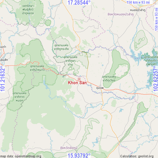
Khon San GPS coordinates[2]
16° 36' 46.296" North, 101° 55' 9.984" East
| Map corner | latitude | longitude |
|---|---|---|
| Upper-left | 17.28544°, | 101.21632° |
| Center: | 16.61286°, | 101.91944° |
| Lower-right: | 15.93792°, | 102.62257° |
| Map W x H: | 149.8×149.8 km | = 93.1×93.1mi |
| max Lat: | 20.43353° ⇑26.4% North |
| Khon San: | 16.61286° |
| min Lat: | ⇓73.6% South 5.77434° |
| min Long | Khon San | max Long |
| 97.93288° | 101.91944° | 105.49506° |
| W 66.1%⇐ | ⇒33.9% E |
Elevation
Elevation of Khon San is 250 m = 820 ft, and this is 124.5 m = 408 ft above average elevation for this country.
| Max E: |
1011 m = 3317 ft | 11.9% |
| Khon San | 250 m 820 ft | |
| Avg. | 125.5 m = 412 ft | |
Min E: |
1 m = 3 ft | 88.1% |
See also: Thailand elevation on elevation.city.
Geographical zone
Khon San is located in North Torrid zone (between Equator and Tropic of Cancer). Distance of this Northern Tropic circle is 758.7 km =471.4 mi to North.| Distance of | km | miles | from Khon San |
|---|---|---|---|
| North Pole | 8159.9 | 5070.3 | to North |
| Arctic Circle | 5554 | 3451.1 | to North |
| Tropic Cancer | 758.7 | 471.4 | to North |
| Equator | 1847.2 | 1147.8 | to South |


Nearby cities:
15 places around Khon San: (largest is in red/bold)
• Ban Thaen
50.7 km =31.5 mi,  117°
117°
• Chum Phae
20.6 km =12.8 mi,  111°
111°
• Kaset Sombun
37.1 km =23.1 mi,  174°
174°
• Nam Nao
31.7 km =19.7 mi,  302°
302°
• Nong Hin
57.2 km =35.5 mi,  353°
353°
• Nong Na Kham
49.2 km =30.6 mi,  64°
64°
• Nong Ruea
56.4 km =35 mi,  103°
103°
• Pha Khao
51.6 km =32.1 mi,  13°
13°
• Phu Khiao
34.5 km =21.4 mi,  139°
139°
• Phu Kradueng
30.4 km =18.9 mi, 353°
• Phu Pha Man
4.5 km =2.8 mi,  333°
333°
• Phu Wiang
48.8 km =30.3 mi,  84°
84°
• Si Bun Rueang
54.7 km =34 mi,  43°
43°
• Si Chomphu
35 km =21.7 mi,  53°
53°
• Wiang Kao
39.7 km =24.7 mi, 78°
Sources, notices
• [Note1] Compared only with cities in Thailand existing in our database
• [Src1] Map data: © OpenStreetMap contributors (CC-BY-SA)
• [Src2] Other city data from geonames.org with taken over terms of usage.
• [Src3] Geographical zone / Annual Mean Temperature by Robert A. Rohde @ Wikipedia
