Ang Thong geodata
Ang Thong is a seat of a first-order administrative division; located in Thailand in Asia/Bangkok (GMT+7) time zone. With population of 13,738 people, there are 238 cities with bigger population in this country. Compared to other cities in Thailand, 58.2% of cities are located further ↑North; 60.1% of cities are located further →East and 80.8% of cities have higher elevation than Ang Thong. Note1


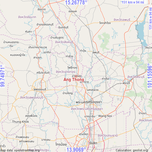
Ang Thong GPS coordinates[2]
14° 35' 18.204" North, 100° 27' 10.188" East
| Map corner | latitude | longitude |
|---|---|---|
| Upper-left | 15.26778°, | 99.74971° |
| Center: | 14.58839°, | 100.45283° |
| Lower-right: | 13.9069°, | 101.15596° |
| Map W x H: | 151.3×151.3 km | = 94×94mi |
| max Lat: | 20.43353° ⇑58.2% North |
| Ang Thong: | 14.58839° |
| min Lat: | ⇓41.8% South 5.77434° |
| min Long | Ang Thong | max Long |
| 97.93288° | 100.45283° | 105.49506° |
| W 39.9%⇐ | ⇒60.1% E |
Elevation
Elevation of Ang Thong is 12 m = 39 ft, and this is 113.5 m = 372 ft below average elevation for this country.
| Max E: |
1011 m = 3317 ft | 80.8% |
| Avg. | 125.5 m = 412 ft | |
| Ang Thong | 12 m = 39 ft | |
Min E: |
1 m = 3 ft | 19.2% |
See also: Thailand elevation on elevation.city.
Geographical zone
Ang Thong is located in North Torrid zone (between Equator and Tropic of Cancer). Distance of this Northern Tropic circle is 983.8 km =611.3 mi to North.| Distance of | km | miles | from Ang Thong |
|---|---|---|---|
| North Pole | 8385 | 5210.2 | to North |
| Arctic Circle | 5779.1 | 3591 | to North |
| Tropic Cancer | 983.8 | 611.3 | to North |
| Equator | 1622.1 | 1007.9 | to South |


Nearby cities:
15 places around Ang Thong: (largest is in red/bold)
• Ban Phraek
14.8 km =9.2 mi,  63°
63°
• Ban Thai Tan
5.2 km =3.2 mi,  45°
45°
• Bang Pahan
17.2 km =10.7 mi,  144°
144°
• Chaiyo
7.3 km =4.5 mi,  22°
22°
• Chaiyo
9.9 km =6.2 mi,  9°
9°
• Don Phut
18.9 km =11.7 mi,  88°
88°
• Maha Rat
10 km =6.2 mi,  127°
127°
• Nakhon Luang
21.8 km =13.5 mi, 129°
• Pa Mok
11 km =6.8 mi,  182°
182°
• Phak Hai
17.1 km =10.6 mi,  211°
211°
• Pho Thong
10 km =6.2 mi,  331°
331°
• Phrom Buri
22.5 km =14 mi,  0°
0°
• Sawaeng Ha
22 km =13.7 mi,  322°
322°
• Tha Chang
20.4 km =12.7 mi,  340°
340°
• Wiset Chaichan
12.3 km =7.6 mi,  273°
273°
Sources, notices
• [Note1] Compared only with cities in Thailand existing in our database
• [Src1] Map data: © OpenStreetMap contributors (CC-BY-SA)
• [Src2] Other city data from geonames.org with taken over terms of usage.
• [Src3] Geographical zone / Annual Mean Temperature by Robert A. Rohde @ Wikipedia
