Chaiyo geodata
Chaiyo (Ang Thong) is a populated place; located in Thailand in Asia/Bangkok (GMT+7) time zone. With population of 13,255 people, there are 250 cities with bigger population in this country. Compared to other cities in Thailand, 55.9% of cities are located further ↑North; 59.8% of cities are located further →East and 76.7% of cities have higher elevation than Chaiyo. Note1


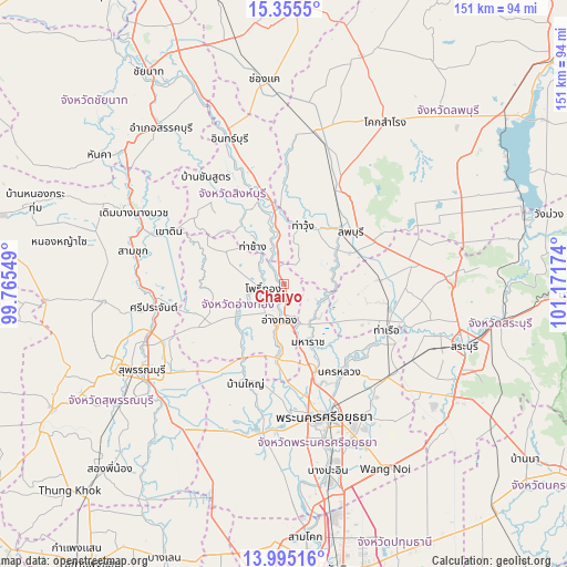
Chaiyo GPS coordinates[2]
14° 40' 35.004" North, 100° 28' 6.996" East
| Map corner | latitude | longitude |
|---|---|---|
| Upper-left | 15.3555°, | 99.76549° |
| Center: | 14.67639°, | 100.46861° |
| Lower-right: | 13.99516°, | 101.17174° |
| Map W x H: | 151.3×151.3 km | = 94×94mi |
| max Lat: | 20.43353° ⇑55.9% North |
| Chaiyo: | 14.67639° |
| min Lat: | ⇓44.1% South 5.77434° |
| min Long | Chaiyo | max Long |
| 97.93288° | 100.46861° | 105.49506° |
| W 40.2%⇐ | ⇒59.8% E |
Elevation
Elevation of Chaiyo is 14 m = 46 ft, and this is 111.5 m = 366 ft below average elevation for this country.
| Max E: |
1011 m = 3317 ft | 76.7% |
| Avg. | 125.5 m = 412 ft | |
| Chaiyo | 14 m = 46 ft | |
Min E: |
1 m = 3 ft | 23.3% |
See also: Thailand elevation on elevation.city.
Geographical zone
Chaiyo is located in North Torrid zone (between Equator and Tropic of Cancer). Distance of this Northern Tropic circle is 974.1 km =605.3 mi to North.| Distance of | km | miles | from Chaiyo |
|---|---|---|---|
| North Pole | 8375.2 | 5204.1 | to North |
| Arctic Circle | 5769.3 | 3584.9 | to North |
| Tropic Cancer | 974.1 | 605.3 | to North |
| Equator | 1631.9 | 1014 | to South |


Nearby cities:
15 places around Chaiyo: (largest is in red/bold)
• Ang Thong
9.9 km =6.2 mi,  189°
189°
• Ban Phraek
12 km =7.5 mi,  105°
105°
• Ban Thai Tan
6.4 km =4 mi,  161°
161°
• Bang Rachan
22 km =13.7 mi,  307°
307°
• Chaiyo
3.3 km =2.1 mi, 160°
• Don Phut
19.6 km =12.2 mi,  118°
118°
• Maha Rat
17.1 km =10.6 mi, 158°
• Pa Mok
20.8 km =12.9 mi, 185°
• Pho Thong
6.5 km =4 mi,  261°
261°
• Phrom Buri
12.8 km =8 mi,  352°
352°
• Sawaeng Ha
16.9 km =10.5 mi,  297°
297°
• Sawaengha
17.6 km =10.9 mi, 298°
• Tha Chang
12.7 km =7.9 mi,  318°
318°
• Tha Wung
15.4 km =9.6 mi,  14°
14°
• Wiset Chaichan
16.7 km =10.4 mi,  237°
237°
Sources, notices
• [Note1] Compared only with cities in Thailand existing in our database
• [Src1] Map data: © OpenStreetMap contributors (CC-BY-SA)
• [Src2] Other city data from geonames.org with taken over terms of usage.
• [Src3] Geographical zone / Annual Mean Temperature by Robert A. Rohde @ Wikipedia
