Dar Chabanne geodata
Dar Chabanne (Nābul) is a populated place; located in Tunisia in Africa/Tunis (GMT+1) time zone. With population of 33,953 people, there are 39 cities with bigger population in this country. Compared to other cities in Tunisia, 67.1% of cities are located further ↓South; 75.5% of cities are located further ←West and 67.8% of cities have higher elevation than Dar Chabanne. Note1


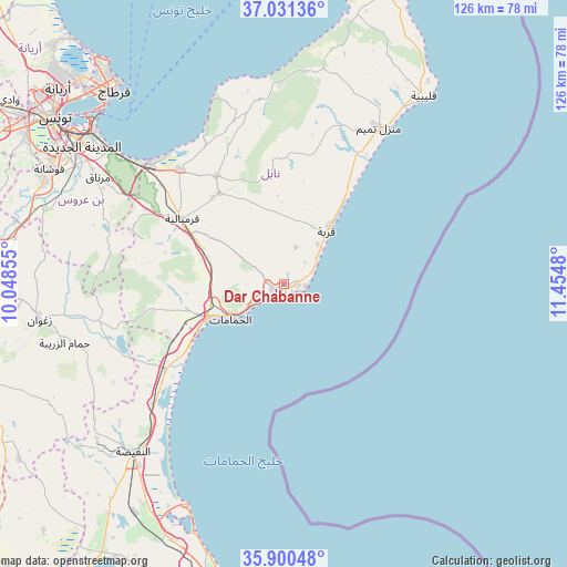
Dar Chabanne GPS coordinates[2]
36° 28' 4.728" North, 10° 45' 6.012" East
| Map corner | latitude | longitude |
|---|---|---|
| Upper-left | 37.03136°, | 10.04855° |
| Center: | 36.46798°, | 10.75167° |
| Lower-right: | 35.90048°, | 11.4548° |
| Map W x H: | 125.7×125.7 km | = 78.1×78.1mi |
| max Lat: | 37.27442° ⇑32.9% North |
| Dar Chabanne: | 36.46798° |
| min Lat: | ⇓67.1% South 32.31662° |
| min Long | Dar Chabanne | max Long |
| 7.87765° | 10.75167° | 11.21965° |
| W 75.5%⇐ | ⇒24.5% E |
Elevation
Elevation of Dar Chabanne is 22 m = 72 ft, and this is 127.4 m = 418 ft below average elevation for this country.
| Max E: |
999 m = 3278 ft | 67.8% |
| Avg. | 149.4 m = 490 ft | |
| Dar Chabanne | 22 m = 72 ft | |
Min E: |
-6 m = -20 ft | 32.2% |
See also: Tunisia elevation on elevation.city.
Geographical zone
Dar Chabanne is located in North temperate zone (between Tropic of Cancer and the Arctic Circle). Distance of this Northern Tropic circle is 1448.9 km =900.3 mi to South.| Distance of | km | miles | from Dar Chabanne |
|---|---|---|---|
| North Pole | 5952.2 | 3698.5 | to North |
| Arctic Circle | 3346.3 | 2079.3 | to North |
| Tropic Cancer | 1448.9 | 900.3 | to South |
| Equator | 4054.9 | 2519.6 | to South |


Nearby cities:
15 places around Dar Chabanne: (largest is in red/bold)
• Beni Khalled
24.9 km =15.5 mi,  324°
324°
• Beni Khiar
2.7 km =1.7 mi,  87°
87°
• Bou Arkoub
19.6 km =12.2 mi,  293°
293°
• Douane
2.3 km =1.4 mi,  170°
170°
• El Maamoura
4.9 km =3 mi, 93°
• El Mida
30.1 km =18.7 mi,  17°
17°
• Hammam-Lif
46.7 km =29 mi,  308°
308°
• Hammamet
14.2 km =8.8 mi,  237°
237°
• Korba
15.6 km =9.7 mi,  37°
37°
• Korbous
42.1 km =26.2 mi,  337°
337°
• Mennzel Bou Zelfa
28.2 km =17.5 mi,  328°
328°
• Menzel Heurr
34.3 km =21.3 mi,  32°
32°
• Nabeul
1.8 km =1.1 mi,  223°
223°
• Takelsa
36.6 km =22.7 mi, 343°
• Zaouiat Djedidi
25.2 km =15.7 mi, 320°
Sources, notices
• [Note1] Compared only with cities in Tunisia existing in our database
• [Src1] Map data: © OpenStreetMap contributors (CC-BY-SA)
• [Src2] Other city data from geonames.org with taken over terms of usage.
• [Src3] Geographical zone / Annual Mean Temperature by Robert A. Rohde @ Wikipedia
