Yayladağı geodata
Yayladağı (Hatay) is a seat of a second-order administrative division; located in Turkey in Europe/Istanbul (GMT+3) time zone. With population of 8,308 people, there are 564 cities with bigger population in this country. Compared to other cities in Turkey, 100% of cities are located further ↑North; 50.4% of cities are located further ←West and 64.8% of cities have higher elevation than Yayladağı. Note1


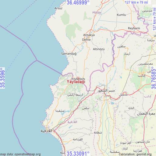
Yayladağı GPS coordinates[2]
35° 54' 9" North, 36° 3' 45.792" East
| Map corner | latitude | longitude |
|---|---|---|
| Upper-left | 36.46999°, | 35.3596° |
| Center: | 35.9025°, | 36.06272° |
| Lower-right: | 35.33091°, | 36.76585° |
| Map W x H: | 126.7×126.7 km | = 78.7×78.7mi |
| max Lat: | 42.02683° ⇑100% North |
| Yayladağı: | 35.9025° |
| min Lat: | ⇓0% South 35.9025° |
| min Long | Yayladağı | max Long |
| 25.90902° | 36.06272° | 44.60099° |
| W 50.4%⇐ | ⇒49.6% E |
Elevation
Elevation of Yayladağı is 421 m = 1381 ft, and this is 296.4 m = 972 ft below average elevation for this country.
| Max E: |
2682 m = 8799 ft | 64.8% |
| Avg. | 717.4 m = 2354 ft | |
| Yayladağı | 421 m = 1381 ft | |
Min E: |
0 m = 0 ft | 35.2% |
See also: Turkey elevation on elevation.city.
Geographical zone
Yayladağı is located in North temperate zone (between Tropic of Cancer and the Arctic Circle). Distance of this Northern Tropic circle is 1386.1 km =861.3 mi to South.| Distance of | km | miles | from Yayladağı |
|---|---|---|---|
| North Pole | 6015.1 | 3737.6 | to North |
| Arctic Circle | 3409.2 | 2118.4 | to North |
| Tropic Cancer | 1386.1 | 861.3 | to South |
| Equator | 3992 | 2480.5 | to South |


Nearby cities:
15 places around Yayladağı: (largest is in red/bold)
• Avuttepe
25.3 km =15.7 mi,  49°
49°
• Balıklıdere
24.6 km =15.3 mi,  8°
8°
• Büyükçat
23.7 km =14.7 mi,  3°
3°
• Gözene
18.7 km =11.6 mi,  345°
345°
• Gümüşgöze
28 km =17.4 mi, 13°
• Hancağız
28.1 km =17.5 mi, 3°
• Harbiye
26.8 km =16.7 mi, 13°
• Karaçay
25.9 km =16.1 mi, 2°
• Kışlak
11.2 km =7 mi, 49°
• Samandağ
21.2 km =13.2 mi,  338°
338°
• Samankaya
28.2 km =17.5 mi, 12°
• Uzunbağ
26.5 km =16.5 mi, 354°
• Yeditepe
8.4 km =5.2 mi,  329°
329°
• Yiğityolu
20.6 km =12.8 mi,  59°
59°
• Şenköy
17.8 km =11.1 mi,  24°
24°
Sources, notices
• [Note1] Compared only with cities in Turkey existing in our database
• [Src1] Map data: © OpenStreetMap contributors (CC-BY-SA)
• [Src2] Other city data from geonames.org with taken over terms of usage.
• [Src3] Geographical zone / Annual Mean Temperature by Robert A. Rohde @ Wikipedia
