Kışlak geodata
Kışlak (Hatay) is a seat of a third-order administrative division; located in Turkey in Europe/Istanbul (GMT+3) time zone. With population of 1,722 people, there are 987 cities with bigger population in this country. Compared to other cities in Turkey, 100% of cities are located further ↑North; 51.8% of cities are located further ←West and 54.6% of cities have higher elevation than Kışlak. Note1


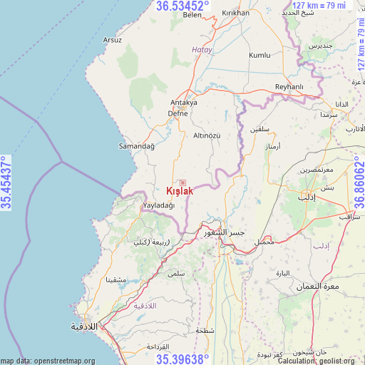
Kışlak GPS coordinates[2]
35° 58' 3" North, 36° 9' 26.964" East
| Map corner | latitude | longitude |
|---|---|---|
| Upper-left | 36.53452°, | 35.45437° |
| Center: | 35.9675°, | 36.15749° |
| Lower-right: | 35.39638°, | 36.86062° |
| Map W x H: | 126.5×126.5 km | = 78.6×78.6mi |
| max Lat: | 42.02683° ⇑100% North |
| Kışlak: | 35.9675° |
| min Lat: | ⇓0% South 35.9025° |
| min Long | Kışlak | max Long |
| 25.90902° | 36.15749° | 44.60099° |
| W 51.8%⇐ | ⇒48.2% E |
Elevation
Elevation of Kışlak is 602 m = 1975 ft, and this is 115.4 m = 379 ft below average elevation for this country.
| Max E: |
2682 m = 8799 ft | 54.6% |
| Avg. | 717.4 m = 2354 ft | |
| Kışlak | 602 m = 1975 ft | |
Min E: |
0 m = 0 ft | 45.4% |
See also: Turkey elevation on elevation.city.
Geographical zone
Kışlak is located in North temperate zone (between Tropic of Cancer and the Arctic Circle). Distance of this Northern Tropic circle is 1393.3 km =865.8 mi to South.| Distance of | km | miles | from Kışlak |
|---|---|---|---|
| North Pole | 6007.9 | 3733.1 | to North |
| Arctic Circle | 3402 | 2113.9 | to North |
| Tropic Cancer | 1393.3 | 865.8 | to South |
| Equator | 3999.2 | 2485 | to South |


Nearby cities:
15 places around Kışlak: (largest is in red/bold)
• Altınözü
17.9 km =11.1 mi,  25°
25°
• Avuttepe
14.2 km =8.8 mi,  48°
48°
• Babatorun
17.1 km =10.6 mi,  44°
44°
• Balıklıdere
17.7 km =11 mi,  344°
344°
• Büyükçat
17.9 km =11.1 mi, 336°
• Gözene
17.2 km =10.7 mi,  309°
309°
• Gümüşgöze
20.2 km =12.6 mi,  353°
353°
• Harbiye
19 km =11.8 mi, 353°
• Karaçay
20 km =12.4 mi, 338°
• Samandağ
20.6 km =12.8 mi, 307°
• Samankaya
20.5 km =12.7 mi, 352°
• Yayladağı
11.2 km =7 mi,  229°
229°
• Yeditepe
12.9 km =8 mi,  270°
270°
• Yiğityolu
9.7 km =6 mi,  71°
71°
• Şenköy
9.1 km =5.7 mi, 352°
Sources, notices
• [Note1] Compared only with cities in Turkey existing in our database
• [Src1] Map data: © OpenStreetMap contributors (CC-BY-SA)
• [Src2] Other city data from geonames.org with taken over terms of usage.
• [Src3] Geographical zone / Annual Mean Temperature by Robert A. Rohde @ Wikipedia
