Yapraktepe geodata
Yapraktepe (Siirt) is a populated place; located in Turkey in Europe/Istanbul (GMT+3) time zone. With population of 809 people, there are 1147 cities with bigger population in this country. Compared to other cities in Turkey, 68.1% of cities are located further ↑North; 95.6% of cities are located further ←West and 92.3% of cities have lower elevation than Yapraktepe. Note1


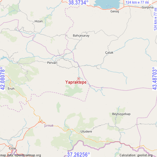
Yapraktepe GPS coordinates[2]
37° 49' 12.252" North, 42° 47' 2.04" East
| Map corner | latitude | longitude |
|---|---|---|
| Upper-left | 38.3734°, | 42.08078° |
| Center: | 37.82007°, | 42.7839° |
| Lower-right: | 37.26256°, | 43.48703° |
| Map W x H: | 123.5×123.5 km | = 76.7×76.7mi |
| max Lat: | 42.02683° ⇑68.1% North |
| Yapraktepe: | 37.82007° |
| min Lat: | ⇓31.9% South 35.9025° |
| min Long | Yapraktepe | max Long |
| 25.90902° | 42.7839° | 44.60099° |
| W 95.6%⇐ | ⇒4.4% E |
Elevation
Elevation of Yapraktepe is 1548 m = 5079 ft, and this is 830.6 m = 2725 ft above average elevation for this country.
| Max E: |
2682 m = 8799 ft | 7.7% |
| Yapraktepe | 1548 m 5079 ft | |
| Avg. | 717.4 m = 2354 ft | |
Min E: |
0 m = 0 ft | 92.3% |
See also: Turkey elevation on elevation.city.
Geographical zone
Yapraktepe is located in North temperate zone (between Tropic of Cancer and the Arctic Circle). Distance of this Northern Tropic circle is 1599.3 km =993.8 mi to South.| Distance of | km | miles | from Yapraktepe |
|---|---|---|---|
| North Pole | 5801.9 | 3605.1 | to North |
| Arctic Circle | 3196 | 1985.9 | to North |
| Tropic Cancer | 1599.3 | 993.8 | to South |
| Equator | 4205.2 | 2613 | to South |


Nearby cities:
15 places around Yapraktepe: (largest is in red/bold)
• Atlıhan
11.5 km =7.1 mi,  16°
16°
• Ayvalıbağ
30.8 km =19.1 mi,  299°
299°
• Belenoluk
10.6 km =6.6 mi,  356°
356°
• Beğendik
21 km =13 mi,  325°
325°
• Doğanköy
6.3 km =3.9 mi,  175°
175°
• Gökbudak
15.1 km =9.4 mi,  308°
308°
• Güleçler
26.1 km =16.2 mi, 304°
• Kaçıt
21.8 km =13.5 mi,  55°
55°
• Konalga
27.8 km =17.3 mi,  80°
80°
• Narlı
18.3 km =11.4 mi,  66°
66°
• Ormandalı
29.5 km =18.3 mi, 297°
• Pervari
24.3 km =15.1 mi, 301°
• Uzyum
20.6 km =12.8 mi,  342°
342°
• Yukarı Balcılar
17.6 km =10.9 mi, 303°
• Övecek
12.8 km =8 mi,  43°
43°
Sources, notices
• [Note1] Compared only with cities in Turkey existing in our database
• [Src1] Map data: © OpenStreetMap contributors (CC-BY-SA)
• [Src2] Other city data from geonames.org with taken over terms of usage.
• [Src3] Geographical zone / Annual Mean Temperature by Robert A. Rohde @ Wikipedia
