Belenoluk geodata
Belenoluk (Siirt) is a populated place; located in Turkey in Europe/Istanbul (GMT+3) time zone. With population of 910 people, there are 1115 cities with bigger population in this country. Compared to other cities in Turkey, 64.3% of cities are located further ↑North; 95.5% of cities are located further ←West and 81.5% of cities have lower elevation than Belenoluk. Note1


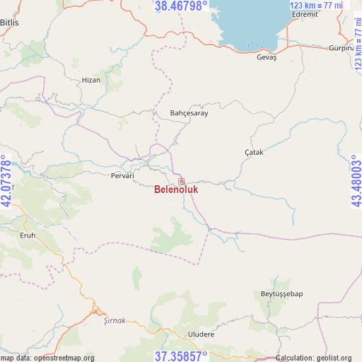
Belenoluk GPS coordinates[2]
37° 54' 55.332" North, 42° 46' 36.84" East
| Map corner | latitude | longitude |
|---|---|---|
| Upper-left | 38.46798°, | 42.07378° |
| Center: | 37.91537°, | 42.7769° |
| Lower-right: | 37.35857°, | 43.48003° |
| Map W x H: | 123.4×123.4 km | = 76.7×76.7mi |
| max Lat: | 42.02683° ⇑64.3% North |
| Belenoluk: | 37.91537° |
| min Lat: | ⇓35.7% South 35.9025° |
| min Long | Belenoluk | max Long |
| 25.90902° | 42.7769° | 44.60099° |
| W 95.5%⇐ | ⇒4.5% E |
Elevation
Elevation of Belenoluk is 1223 m = 4012 ft, and this is 505.6 m = 1659 ft above average elevation for this country.
| Max E: |
2682 m = 8799 ft | 18.5% |
| Belenoluk | 1223 m 4012 ft | |
| Avg. | 717.4 m = 2354 ft | |
Min E: |
0 m = 0 ft | 81.5% |
See also: Turkey elevation on elevation.city.
Geographical zone
Belenoluk is located in North temperate zone (between Tropic of Cancer and the Arctic Circle). Distance of this Northern Tropic circle is 1609.9 km =1000.3 mi to South.| Distance of | km | miles | from Belenoluk |
|---|---|---|---|
| North Pole | 5791.3 | 3598.5 | to North |
| Arctic Circle | 3185.4 | 1979.3 | to North |
| Tropic Cancer | 1609.9 | 1000.3 | to South |
| Equator | 4215.8 | 2619.6 | to South |


Nearby cities:
15 places around Belenoluk: (largest is in red/bold)
• Atlıhan
3.9 km =2.4 mi,  83°
83°
• Bahçesaray
23.3 km =14.5 mi,  4°
4°
• Beğendik
13.1 km =8.1 mi,  300°
300°
• Doğanköy
16.9 km =10.5 mi,  176°
176°
• Gökbudak
11.3 km =7 mi,  263°
263°
• Güleçler
21.3 km =13.2 mi,  281°
281°
• Kaçıt
18.7 km =11.6 mi, 84°
• Narlı
17.8 km =11.1 mi,  101°
101°
• Ormandalı
25.7 km =16 mi, 276°
• Pervari
20.1 km =12.5 mi, 276°
• Simos
23.1 km =14.4 mi,  312°
312°
• Uzyum
10.7 km =6.6 mi,  327°
327°
• Yapraktepe
10.6 km =6.6 mi, 176°
• Yukarı Balcılar
14.1 km =8.8 mi,  266°
266°
• Övecek
9.5 km =5.9 mi, 97°
Sources, notices
• [Note1] Compared only with cities in Turkey existing in our database
• [Src1] Map data: © OpenStreetMap contributors (CC-BY-SA)
• [Src2] Other city data from geonames.org with taken over terms of usage.
• [Src3] Geographical zone / Annual Mean Temperature by Robert A. Rohde @ Wikipedia
