Yukarı Balcılar geodata
Yukarı Balcılar (Siirt) is a populated place; located in Turkey in Europe/Istanbul (GMT+3) time zone. With population of 670 people, there are 1211 cities with bigger population in this country. Compared to other cities in Turkey, 64.6% of cities are located further ↑North; 94.9% of cities are located further ←West and 90.6% of cities have lower elevation than Yukarı Balcılar. Note1


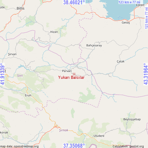
Yukarı Balcılar GPS coordinates[2]
37° 54' 27.144" North, 42° 36' 59.436" East
| Map corner | latitude | longitude |
|---|---|---|
| Upper-left | 38.46021°, | 41.91339° |
| Center: | 37.90754°, | 42.61651° |
| Lower-right: | 37.35068°, | 43.31964° |
| Map W x H: | 123.4×123.4 km | = 76.7×76.7mi |
| max Lat: | 42.02683° ⇑64.6% North |
| Yukarı Balcılar: | 37.90754° |
| min Lat: | ⇓35.4% South 35.9025° |
| min Long | Yukarı Balcıl | max Long |
| 25.90902° | 42.61651° | 44.60099° |
| W 94.9%⇐ | ⇒5.1% E |
Elevation
Elevation of Yukarı Balcılar is 1499 m = 4918 ft, and this is 781.6 m = 2564 ft above average elevation for this country.
| Max E: |
2682 m = 8799 ft | 9.4% |
| Yukarı Balcılar | 1499 m 4918 ft | |
| Avg. | 717.4 m = 2354 ft | |
Min E: |
0 m = 0 ft | 90.6% |
See also: Turkey elevation on elevation.city.
Geographical zone
Yukarı Balcılar is located in North temperate zone (between Tropic of Cancer and the Arctic Circle). Distance of this Northern Tropic circle is 1609 km =999.8 mi to South.| Distance of | km | miles | from Yukarı Balcılar |
|---|---|---|---|
| North Pole | 5792.1 | 3599 | to North |
| Arctic Circle | 3186.3 | 1979.9 | to North |
| Tropic Cancer | 1609 | 999.8 | to South |
| Equator | 4214.9 | 2619 | to South |


Nearby cities:
15 places around Yukarı Balcılar: (largest is in red/bold)
• Akşar
22.6 km =14 mi,  341°
341°
• Atlıhan
18 km =11.2 mi,  85°
85°
• Ayvalıbağ
13.2 km =8.2 mi,  294°
294°
• Belenoluk
14.1 km =8.8 mi, 86°
• Beğendik
8.1 km =5 mi,  20°
20°
• Doğanköy
22.1 km =13.7 mi,  136°
136°
• Gökbudak
2.9 km =1.8 mi,  98°
98°
• Gökçekoru
15.6 km =9.7 mi, 290°
• Güleçler
8.5 km =5.3 mi,  306°
306°
• Ormandalı
12.1 km =7.5 mi, 288°
• Pervari
6.7 km =4.2 mi,  297°
297°
• Simos
16.9 km =10.5 mi,  350°
350°
• Uzyum
13 km =8.1 mi,  40°
40°
• Yapraktepe
17.6 km =10.9 mi,  123°
123°
• Yeniaydın
16.2 km =10.1 mi,  259°
259°
Sources, notices
• [Note1] Compared only with cities in Turkey existing in our database
• [Src1] Map data: © OpenStreetMap contributors (CC-BY-SA)
• [Src2] Other city data from geonames.org with taken over terms of usage.
• [Src3] Geographical zone / Annual Mean Temperature by Robert A. Rohde @ Wikipedia
