Şenoba geodata
Şenoba (Şırnak) is a populated place; located in Turkey in Europe/Istanbul (GMT+3) time zone. With population of 4,687 people, there are 746 cities with bigger population in this country. Compared to other cities in Turkey, 75.7% of cities are located further ↑North; 95.2% of cities are located further ←West and 61.3% of cities have lower elevation than Şenoba. Note1


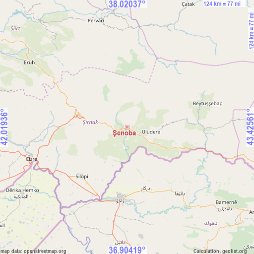
Şenoba GPS coordinates[2]
37° 27' 51.696" North, 42° 43' 20.928" East
| Map corner | latitude | longitude |
|---|---|---|
| Upper-left | 38.02037°, | 42.01936° |
| Center: | 37.46436°, | 42.72248° |
| Lower-right: | 36.90419°, | 43.42561° |
| Map W x H: | 124.1×124.1 km | = 77.1×77.1mi |
| max Lat: | 42.02683° ⇑75.7% North |
| Şenoba: | 37.46436° |
| min Lat: | ⇓24.3% South 35.9025° |
| min Long | Şenoba | max Long |
| 25.90902° | 42.72248° | 44.60099° |
| W 95.2%⇐ | ⇒4.8% E |
Elevation
Elevation of Şenoba is 902 m = 2959 ft, and this is 184.6 m = 606 ft above average elevation for this country.
| Max E: |
2682 m = 8799 ft | 38.7% |
| Şenoba | 902 m 2959 ft | |
| Avg. | 717.4 m = 2354 ft | |
Min E: |
0 m = 0 ft | 61.3% |
See also: Turkey elevation on elevation.city.
Geographical zone
Şenoba is located in North temperate zone (between Tropic of Cancer and the Arctic Circle). Distance of this Northern Tropic circle is 1559.7 km =969.2 mi to South.| Distance of | km | miles | from Şenoba |
|---|---|---|---|
| North Pole | 5841.4 | 3629.7 | to North |
| Arctic Circle | 3235.5 | 2010.4 | to North |
| Tropic Cancer | 1559.7 | 969.2 | to South |
| Equator | 4165.6 | 2588.4 | to South |


Nearby cities:
15 places around Şenoba: (largest is in red/bold)
• Ballı
11.8 km =7.3 mi,  118°
118°
• Balveren
15.5 km =9.6 mi,  277°
277°
• Bağlıca
5.7 km =3.5 mi,  127°
127°
• Becuh
25 km =15.5 mi,  108°
108°
• Bisbin
19.4 km =12.1 mi,  224°
224°
• Boğazören
26.1 km =16.2 mi,  74°
74°
• Geçitboyu
18.2 km =11.3 mi, 279°
• Hilal
5.7 km =3.5 mi,  77°
77°
• Ortabağ
18.2 km =11.3 mi, 114°
• Ortasu
23.4 km =14.5 mi, 117°
• Taşdelen
16 km =9.9 mi, 126°
• Uludere
11.8 km =7.3 mi,  102°
102°
• Uzungeçit
23.8 km =14.8 mi, 82°
• Çalışkan
19.9 km =12.4 mi,  200°
200°
• Şırnak
24.3 km =15.1 mi, 283°
Sources, notices
• [Note1] Compared only with cities in Turkey existing in our database
• [Src1] Map data: © OpenStreetMap contributors (CC-BY-SA)
• [Src2] Other city data from geonames.org with taken over terms of usage.
• [Src3] Geographical zone / Annual Mean Temperature by Robert A. Rohde @ Wikipedia
