Ortaköy geodata
Ortaköy (Mardin) is a populated place; located in Turkey in Europe/Istanbul (GMT+3) time zone. With population of 5,120 people, there are 713 cities with bigger population in this country. Compared to other cities in Turkey, 82.7% of cities are located further ↑North; 79.4% of cities are located further ←West and 56% of cities have higher elevation than Ortaköy. Note1


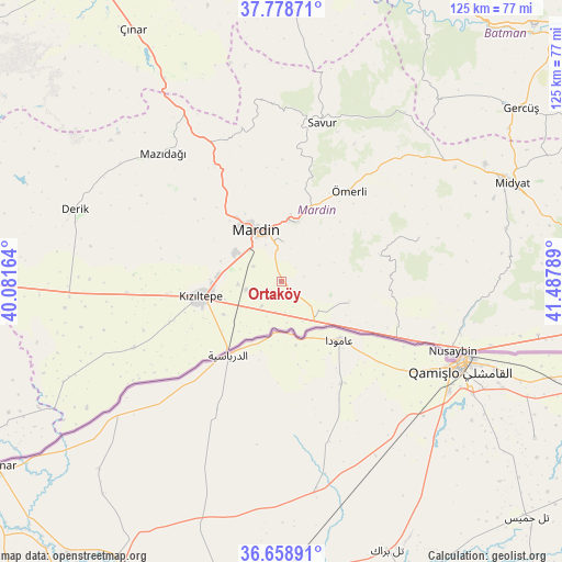
Ortaköy GPS coordinates[2]
37° 13' 15.204" North, 40° 47' 5.136" East
| Map corner | latitude | longitude |
|---|---|---|
| Upper-left | 37.77871°, | 40.08164° |
| Center: | 37.22089°, | 40.78476° |
| Lower-right: | 36.65891°, | 41.48789° |
| Map W x H: | 124.5×124.5 km | = 77.4×77.4mi |
| max Lat: | 42.02683° ⇑82.7% North |
| Ortaköy: | 37.22089° |
| min Lat: | ⇓17.3% South 35.9025° |
| min Long | Ortaköy | max Long |
| 25.90902° | 40.78476° | 44.60099° |
| W 79.4%⇐ | ⇒20.6% E |
Elevation
Elevation of Ortaköy is 572 m = 1877 ft, and this is 145.4 m = 477 ft below average elevation for this country.
| Max E: |
2682 m = 8799 ft | 56% |
| Avg. | 717.4 m = 2354 ft | |
| Ortaköy | 572 m = 1877 ft | |
Min E: |
0 m = 0 ft | 44% |
See also: Turkey elevation on elevation.city.
Geographical zone
Ortaköy is located in North temperate zone (between Tropic of Cancer and the Arctic Circle). Distance of this Northern Tropic circle is 1532.7 km =952.4 mi to South.| Distance of | km | miles | from Ortaköy |
|---|---|---|---|
| North Pole | 5868.5 | 3646.5 | to North |
| Arctic Circle | 3262.6 | 2027.3 | to North |
| Tropic Cancer | 1532.7 | 952.4 | to South |
| Equator | 4138.6 | 2571.6 | to South |


Nearby cities:
15 places around Ortaköy: (largest is in red/bold)
• Akıncı
8.2 km =5.1 mi,  137°
137°
• Arpatepe
9.3 km =5.8 mi,  173°
173°
• Ashagy-Tomik
9.5 km =5.9 mi,  286°
286°
• Boztepe
7.2 km =4.5 mi,  234°
234°
• Eryeri
8.9 km =5.5 mi,  337°
337°
• Eskin
9.4 km =5.8 mi,  266°
266°
• Eymirli
10.3 km =6.4 mi,  237°
237°
• Göllü
7 km =4.3 mi,  298°
298°
• Hatunlu
9.5 km =5.9 mi,  196°
196°
• Kumlu
7 km =4.3 mi,  218°
218°
• Kuyulu
7 km =4.3 mi, 174°
• Selah
7.9 km =4.9 mi,  257°
257°
• Shaklan
6.8 km =4.2 mi,  190°
190°
• Yaylı
3.4 km =2.1 mi, 233°
• Yukarı Azıklı
10.8 km =6.7 mi, 297°
Sources, notices
• [Note1] Compared only with cities in Turkey existing in our database
• [Src1] Map data: © OpenStreetMap contributors (CC-BY-SA)
• [Src2] Other city data from geonames.org with taken over terms of usage.
• [Src3] Geographical zone / Annual Mean Temperature by Robert A. Rohde @ Wikipedia
