Kovancılar geodata
Kovancılar (Elazığ) is a seat of a second-order administrative division; located in Turkey in Europe/Istanbul (GMT+3) time zone. With population of 22,976 people, there are 305 cities with bigger population in this country. Compared to other cities in Turkey, 50.3% of cities are located further ↓South; 72.9% of cities are located further ←West and 65.7% of cities have lower elevation than Kovancılar. Note1


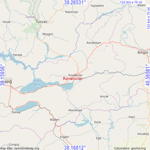
Kovancılar GPS coordinates[2]
38° 43' 7.752" North, 39° 51' 45.648" East
| Map corner | latitude | longitude |
|---|---|---|
| Upper-left | 39.26531°, | 39.15956° |
| Center: | 38.71882°, | 39.86268° |
| Lower-right: | 38.16812°, | 40.56581° |
| Map W x H: | 122×122 km | = 75.8×75.8mi |
| max Lat: | 42.02683° ⇑49.7% North |
| Kovancılar: | 38.71882° |
| min Lat: | ⇓50.3% South 35.9025° |
| min Long | Kovancılar | max Long |
| 25.90902° | 39.86268° | 44.60099° |
| W 72.9%⇐ | ⇒27.1% E |
Elevation
Elevation of Kovancılar is 971 m = 3186 ft, and this is 253.6 m = 832 ft above average elevation for this country.
| Max E: |
2682 m = 8799 ft | 34.3% |
| Kovancılar | 971 m 3186 ft | |
| Avg. | 717.4 m = 2354 ft | |
Min E: |
0 m = 0 ft | 65.7% |
See also: Turkey elevation on elevation.city.
Geographical zone
Kovancılar is located in North temperate zone (between Tropic of Cancer and the Arctic Circle). Distance of this Northern Tropic circle is 1699.2 km =1055.8 mi to South.| Distance of | km | miles | from Kovancılar |
|---|---|---|---|
| North Pole | 5701.9 | 3543 | to North |
| Arctic Circle | 3096 | 1923.8 | to North |
| Tropic Cancer | 1699.2 | 1055.8 | to South |
| Equator | 4305.1 | 2675.1 | to South |


Nearby cities:
15 places around Kovancılar: (largest is in red/bold)
• Akpazar
22 km =13.7 mi,  310°
310°
• Alacakaya
29.1 km =18.1 mi,  180°
180°
• Arıcak
28.6 km =17.8 mi,  127°
127°
• Başyurt
16.4 km =10.2 mi,  38°
38°
• Darıkent
27.5 km =17.1 mi,  350°
350°
• Gökdere
30.1 km =18.7 mi,  84°
84°
• Karakoçan
29.6 km =18.4 mi,  28°
28°
• Maden
40.8 km =25.4 mi,  205°
205°
• Mazgirt
40.2 km =25 mi,  325°
325°
• Palu
5.8 km =3.6 mi,  121°
121°
• Pınarlar
38 km =23.6 mi,  297°
297°
• Servi
43 km =26.7 mi,  112°
112°
• Çaybağı
21.2 km =13.2 mi,  262°
262°
• Çaybağı
25 km =15.5 mi, 299°
• İçme
29.5 km =18.3 mi,  246°
246°
Sources, notices
• [Note1] Compared only with cities in Turkey existing in our database
• [Src1] Map data: © OpenStreetMap contributors (CC-BY-SA)
• [Src2] Other city data from geonames.org with taken over terms of usage.
• [Src3] Geographical zone / Annual Mean Temperature by Robert A. Rohde @ Wikipedia
