Karakoçan geodata
Karakoçan (Elazığ) is a seat of a second-order administrative division; located in Turkey in Europe/Istanbul (GMT+3) time zone. With population of 29,735 people, there are 254 cities with bigger population in this country. Compared to other cities in Turkey, 53.8% of cities are located further ↓South; 73.6% of cities are located further ←West and 73.9% of cities have lower elevation than Karakoçan. Note1


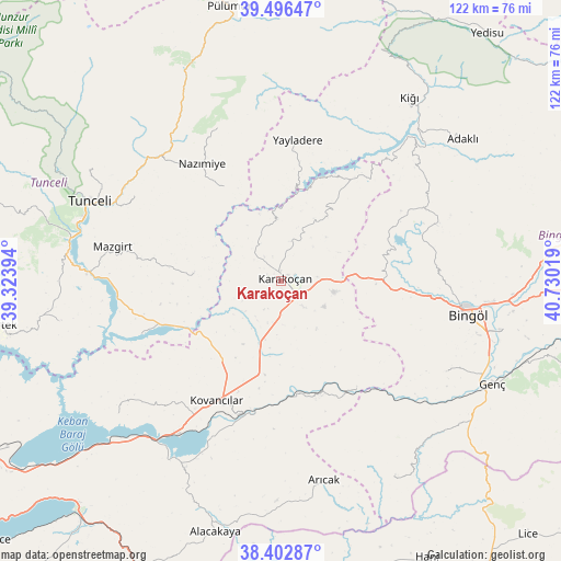
Karakoçan GPS coordinates[2]
38° 57' 6.408" North, 40° 1' 37.416" East
| Map corner | latitude | longitude |
|---|---|---|
| Upper-left | 39.49647°, | 39.32394° |
| Center: | 38.95178°, | 40.02706° |
| Lower-right: | 38.40287°, | 40.73019° |
| Map W x H: | 121.6×121.6 km | = 75.6×75.6mi |
| max Lat: | 42.02683° ⇑46.2% North |
| Karakoçan: | 38.95178° |
| min Lat: | ⇓53.8% South 35.9025° |
| min Long | Karakoçan | max Long |
| 25.90902° | 40.02706° | 44.60099° |
| W 73.6%⇐ | ⇒26.4% E |
Elevation
Elevation of Karakoçan is 1087 m = 3566 ft, and this is 369.6 m = 1213 ft above average elevation for this country.
| Max E: |
2682 m = 8799 ft | 26.1% |
| Karakoçan | 1087 m 3566 ft | |
| Avg. | 717.4 m = 2354 ft | |
Min E: |
0 m = 0 ft | 73.9% |
See also: Turkey elevation on elevation.city.
Geographical zone
Karakoçan is located in North temperate zone (between Tropic of Cancer and the Arctic Circle). Distance of this Northern Tropic circle is 1725.1 km =1071.9 mi to South.| Distance of | km | miles | from Karakoçan |
|---|---|---|---|
| North Pole | 5676 | 3526.9 | to North |
| Arctic Circle | 3070.1 | 1907.7 | to North |
| Tropic Cancer | 1725.1 | 1071.9 | to South |
| Equator | 4331 | 2691.2 | to South |


Nearby cities:
15 places around Karakoçan: (largest is in red/bold)
• Akpazar
33.2 km =20.6 mi,  249°
249°
• Başyurt
13.6 km =8.5 mi,  197°
197°
• Dallıbahçe
23.9 km =14.9 mi,  327°
327°
• Darıkent
19 km =11.8 mi,  273°
273°
• Dereova
35.9 km =22.3 mi,  337°
337°
• Gökdere
28 km =17.4 mi,  145°
145°
• Kocakoç
36.7 km =22.8 mi,  299°
299°
• Kovancılar
29.6 km =18.4 mi,  208°
208°
• Mazgirt
37.6 km =23.4 mi,  281°
281°
• Nazimiye
30.6 km =19 mi, 325°
• Palu
30.4 km =18.9 mi, 197°
• Sancak
34.8 km =21.6 mi,  63°
63°
• Yayladere
30.7 km =19.1 mi,  6°
6°
• Çan
26.6 km =16.5 mi,  34°
34°
• Çaybağı
38.6 km =24 mi, 249°
Sources, notices
• [Note1] Compared only with cities in Turkey existing in our database
• [Src1] Map data: © OpenStreetMap contributors (CC-BY-SA)
• [Src2] Other city data from geonames.org with taken over terms of usage.
• [Src3] Geographical zone / Annual Mean Temperature by Robert A. Rohde @ Wikipedia
