İncirliova geodata
İncirliova (Aydın) is a seat of a second-order administrative division; located in Turkey in Europe/Istanbul (GMT+3) time zone. With population of 18,572 people, there are 349 cities with bigger population in this country. Compared to other cities in Turkey, 66.9% of cities are located further ↑North; 92% of cities are located further →East and 88.4% of cities have higher elevation than İncirliova. Note1


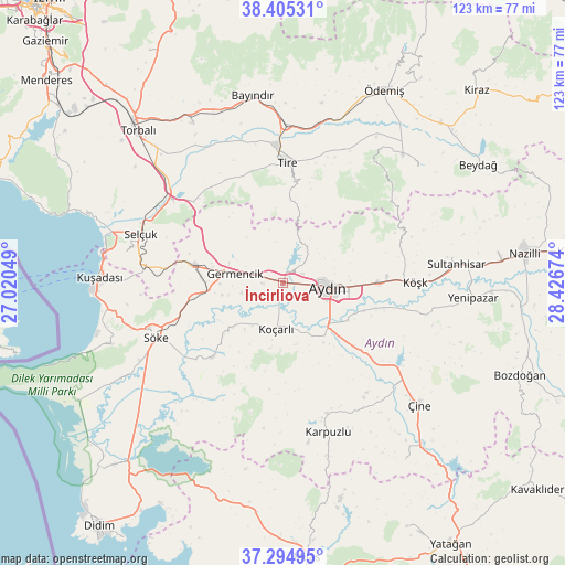
İncirliova GPS coordinates[2]
37° 51' 7.992" North, 27° 43' 24.996" East
| Map corner | latitude | longitude |
|---|---|---|
| Upper-left | 38.40531°, | 27.02049° |
| Center: | 37.85222°, | 27.72361° |
| Lower-right: | 37.29495°, | 28.42674° |
| Map W x H: | 123.5×123.5 km | = 76.7×76.7mi |
| max Lat: | 42.02683° ⇑66.9% North |
| İncirliova: | 37.85222° |
| min Lat: | ⇓33.1% South 35.9025° |
| min Long | İncirliova | max Long |
| 25.90902° | 27.72361° | 44.60099° |
| W 8%⇐ | ⇒92% E |
Elevation
Elevation of İncirliova is 48 m = 157 ft, and this is 669.4 m = 2196 ft below average elevation for this country.
| Max E: |
2682 m = 8799 ft | 88.4% |
| Avg. | 717.4 m = 2354 ft | |
| İncirliova | 48 m = 157 ft | |
Min E: |
0 m = 0 ft | 11.6% |
See also: Turkey elevation on elevation.city.
Geographical zone
İncirliova is located in North temperate zone (between Tropic of Cancer and the Arctic Circle). Distance of this Northern Tropic circle is 1602.9 km =996 mi to South.| Distance of | km | miles | from İncirliova |
|---|---|---|---|
| North Pole | 5798.3 | 3602.9 | to North |
| Arctic Circle | 3192.4 | 1983.7 | to North |
| Tropic Cancer | 1602.9 | 996 | to South |
| Equator | 4208.8 | 2615.2 | to South |


Nearby cities:
15 places around İncirliova: (largest is in red/bold)
• Acarlar
3.7 km =2.3 mi,  146°
146°
• Aydın
10.2 km =6.3 mi,  94°
94°
• Bağarası
22.3 km =13.9 mi,  223°
223°
• Belevi
30 km =18.6 mi,  307°
307°
• Boğaziçi
24.9 km =15.5 mi,  324°
324°
• Dalama
30.9 km =19.2 mi,  102°
102°
• Germencik
10.8 km =6.7 mi,  280°
280°
• Koçarlı
10.2 km =6.3 mi,  188°
188°
• Köşk
28.8 km =17.9 mi, 89°
• Ortaklar
19.8 km =12.3 mi, 281°
• Söke
30.2 km =18.8 mi,  247°
247°
• Tepecik
13.7 km =8.5 mi, 103°
• Tire
26.3 km =16.3 mi,  2°
2°
• Umurlu
21 km =13 mi, 90°
• Çakırbeyli
15.7 km =9.8 mi, 145°
Sources, notices
• [Note1] Compared only with cities in Turkey existing in our database
• [Src1] Map data: © OpenStreetMap contributors (CC-BY-SA)
• [Src2] Other city data from geonames.org with taken over terms of usage.
• [Src3] Geographical zone / Annual Mean Temperature by Robert A. Rohde @ Wikipedia
