Ceylanpınar geodata
Ceylanpınar (Şanlıurfa) is a seat of a second-order administrative division; located in Turkey in Europe/Istanbul (GMT+3) time zone. With population of 31,488 people, there are 241 cities with bigger population in this country. Compared to other cities in Turkey, 92% of cities are located further ↑North; 73.7% of cities are located further ←West and 67.7% of cities have higher elevation than Ceylanpınar. Note1


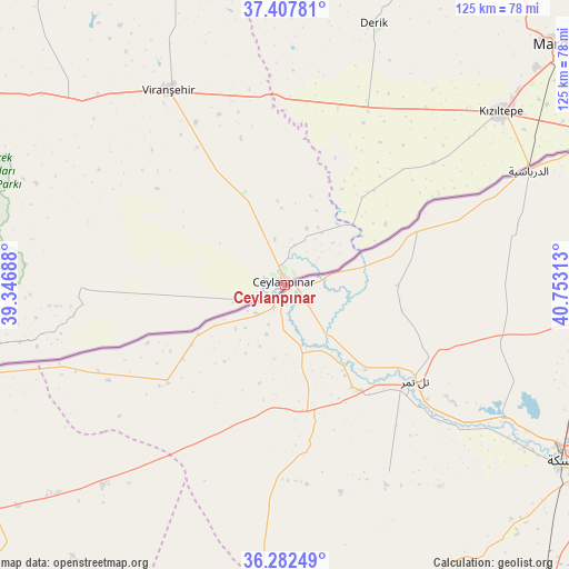
Ceylanpınar GPS coordinates[2]
36° 50' 49.992" North, 40° 3' 0" East
| Map corner | latitude | longitude |
|---|---|---|
| Upper-left | 37.40781°, | 39.34688° |
| Center: | 36.84722°, | 40.05° |
| Lower-right: | 36.28249°, | 40.75313° |
| Map W x H: | 125.1×125.1 km | = 77.7×77.7mi |
| max Lat: | 42.02683° ⇑92% North |
| Ceylanpınar: | 36.84722° |
| min Lat: | ⇓8% South 35.9025° |
| min Long | Ceylanpınar | max Long |
| 25.90902° | 40.05° | 44.60099° |
| W 73.7%⇐ | ⇒26.3% E |
Elevation
Elevation of Ceylanpınar is 362 m = 1188 ft, and this is 355.4 m = 1166 ft below average elevation for this country.
| Max E: |
2682 m = 8799 ft | 67.7% |
| Avg. | 717.4 m = 2354 ft | |
| Ceylanpınar | 362 m = 1188 ft | |
Min E: |
0 m = 0 ft | 32.3% |
See also: Turkey elevation on elevation.city.
Geographical zone
Ceylanpınar is located in North temperate zone (between Tropic of Cancer and the Arctic Circle). Distance of this Northern Tropic circle is 1491.1 km =926.5 mi to South.| Distance of | km | miles | from Ceylanpınar |
|---|---|---|---|
| North Pole | 5910 | 3672.3 | to North |
| Arctic Circle | 3304.1 | 2053.1 | to North |
| Tropic Cancer | 1491.1 | 926.5 | to South |
| Equator | 4097 | 2545.8 | to South |


Nearby cities:
15 places around Ceylanpınar: (largest is in red/bold)
• Avcılı
14 km =8.7 mi,  48°
48°
• Aydoğdu
14 km =8.7 mi,  35°
35°
• Aşağıdoruklu
9.4 km =5.8 mi, 50°
• Boğalı
12.5 km =7.8 mi, 50°
• Büyük Yenice
16.6 km =10.3 mi,  16°
16°
• Büyük Çaylı
44.9 km =27.9 mi,  269°
269°
• Damlacık
8.9 km =5.5 mi,  31°
31°
• Hanköy
17.5 km =10.9 mi, 48°
• Işıklar
17.7 km =11 mi, 22°
• Kocatepe
43.6 km =27.1 mi,  13°
13°
• Muratlı
13.5 km =8.4 mi, 19°
• Yeşiltepe
17.3 km =10.7 mi, 54°
• Yukarı Karataş
8.5 km =5.3 mi,  3°
3°
• Yukarı Taşyalak
14.8 km =9.2 mi, 29°
• Çıplak
19.9 km =12.4 mi,  56°
56°
Sources, notices
• [Note1] Compared only with cities in Turkey existing in our database
• [Src1] Map data: © OpenStreetMap contributors (CC-BY-SA)
• [Src2] Other city data from geonames.org with taken over terms of usage.
• [Src3] Geographical zone / Annual Mean Temperature by Robert A. Rohde @ Wikipedia
