Böğürtlen geodata
Böğürtlen (Şanlıurfa) is a seat of a third-order administrative division; located in Turkey in Europe/Istanbul (GMT+3) time zone. In our database, there are 1323 cities with bigger population. Compared to other cities in Turkey, 84.6% of cities are located further ↑North; 62.1% of cities are located further ←West and 51.1% of cities have lower elevation than Böğürtlen. Note1


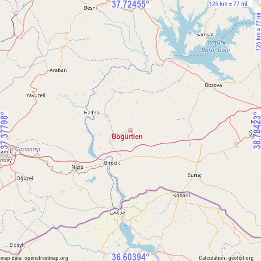
Böğürtlen GPS coordinates[2]
37° 9' 58.752" North, 38° 4' 51.96" East
| Map corner | latitude | longitude |
|---|---|---|
| Upper-left | 37.72455°, | 37.37798° |
| Center: | 37.16632°, | 38.0811° |
| Lower-right: | 36.60394°, | 38.78423° |
| Map W x H: | 124.6×124.6 km | = 77.4×77.4mi |
| max Lat: | 42.02683° ⇑84.6% North |
| Böğürtlen: | 37.16632° |
| min Lat: | ⇓15.4% South 35.9025° |
| min Long | Böğürtlen | max Long |
| 25.90902° | 38.0811° | 44.60099° |
| W 62.1%⇐ | ⇒37.9% E |
Elevation
Elevation of Böğürtlen is 715 m = 2346 ft, and this is 2.4 m = 8 ft below average elevation for this country.
| Max E: |
2682 m = 8799 ft | 48.9% |
| Avg. | 717.4 m = 2354 ft | |
| Böğürtlen | 715 m = 2346 ft | |
Min E: |
0 m = 0 ft | 51.1% |
See also: Turkey elevation on elevation.city.
Geographical zone
Böğürtlen is located in North temperate zone (between Tropic of Cancer and the Arctic Circle). Distance of this Northern Tropic circle is 1526.6 km =948.6 mi to South.| Distance of | km | miles | from Böğürtlen |
|---|---|---|---|
| North Pole | 5874.6 | 3650.3 | to North |
| Arctic Circle | 3268.7 | 2031.1 | to North |
| Tropic Cancer | 1526.6 | 948.6 | to South |
| Equator | 4132.5 | 2567.8 | to South |


Nearby cities:
15 places around Böğürtlen: (largest is in red/bold)
• Akarçay
27.9 km =17.3 mi,  189°
189°
• Arslanlı
20 km =12.4 mi,  174°
174°
• Binatlı
37.2 km =23.1 mi,  134°
134°
• Birecik
18.1 km =11.2 mi,  210°
210°
• Elifoğlu
25.8 km =16 mi,  198°
198°
• Gevence
35.1 km =21.8 mi,  216°
216°
• Halfeti
20.8 km =12.9 mi,  295°
295°
• Kanlıavşar
21 km =13 mi,  74°
74°
• Kelekli
29.1 km =18.1 mi, 195°
• Mağaralı
22 km =13.7 mi,  181°
181°
• Nizip
30.8 km =19.1 mi,  235°
235°
• Suruç
37.1 km =23.1 mi,  124°
124°
• Uysallı
35.9 km =22.3 mi, 131°
• Yaylak
33.2 km =20.6 mi,  43°
43°
• Yonlyu
33.9 km =21.1 mi, 127°
Sources, notices
• [Note1] Compared only with cities in Turkey existing in our database
• [Src1] Map data: © OpenStreetMap contributors (CC-BY-SA)
• [Src2] Other city data from geonames.org with taken over terms of usage.
• [Src3] Geographical zone / Annual Mean Temperature by Robert A. Rohde @ Wikipedia
