Kayaboyun geodata
Kayaboyun (Şırnak) is a populated place; located in Turkey in Europe/Istanbul (GMT+3) time zone. With population of 722 people, there are 1193 cities with bigger population in this country. Compared to other cities in Turkey, 75.5% of cities are located further ↑North; 91.2% of cities are located further ←West and 80.2% of cities have lower elevation than Kayaboyun. Note1


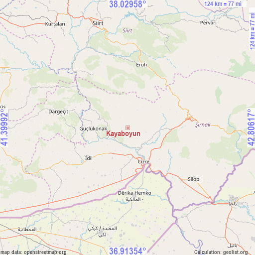
Kayaboyun GPS coordinates[2]
37° 28' 25.104" North, 42° 6' 10.944" East
| Map corner | latitude | longitude |
|---|---|---|
| Upper-left | 38.02958°, | 41.39992° |
| Center: | 37.47364°, | 42.10304° |
| Lower-right: | 36.91354°, | 42.80617° |
| Map W x H: | 124.1×124.1 km | = 77.1×77.1mi |
| max Lat: | 42.02683° ⇑75.5% North |
| Kayaboyun: | 37.47364° |
| min Lat: | ⇓24.5% South 35.9025° |
| min Long | Kayaboyun | max Long |
| 25.90902° | 42.10304° | 44.60099° |
| W 91.2%⇐ | ⇒8.8% E |
Elevation
Elevation of Kayaboyun is 1199 m = 3934 ft, and this is 481.6 m = 1580 ft above average elevation for this country.
| Max E: |
2682 m = 8799 ft | 19.8% |
| Kayaboyun | 1199 m 3934 ft | |
| Avg. | 717.4 m = 2354 ft | |
Min E: |
0 m = 0 ft | 80.2% |
See also: Turkey elevation on elevation.city.
Geographical zone
Kayaboyun is located in North temperate zone (between Tropic of Cancer and the Arctic Circle). Distance of this Northern Tropic circle is 1560.8 km =969.8 mi to South.| Distance of | km | miles | from Kayaboyun |
|---|---|---|---|
| North Pole | 5840.4 | 3629.1 | to North |
| Arctic Circle | 3234.5 | 2009.8 | to North |
| Tropic Cancer | 1560.8 | 969.8 | to South |
| Equator | 4166.7 | 2589.1 | to South |


Nearby cities:
15 places around Kayaboyun: (largest is in red/bold)
• Akdizgin
13.2 km =8.2 mi,  251°
251°
• Baraniferho
17.4 km =10.8 mi,  268°
268°
• Boyuncuk
18 km =11.2 mi, 252°
• Cizre
17.5 km =10.9 mi,  155°
155°
• Dicle
20.8 km =12.9 mi,  188°
188°
• Düzova
13.4 km =8.3 mi, 185°
• Erenkaya
18.3 km =11.4 mi,  348°
348°
• Fındık
13 km =8.1 mi,  289°
289°
• Kumçatı
16.3 km =10.1 mi,  93°
93°
• Kızılsu
8.5 km =5.3 mi,  104°
104°
• Serhatta
21.3 km =13.2 mi,  8°
8°
• Sulak
14.2 km =8.8 mi,  241°
241°
• Sulak
20.1 km =12.5 mi,  171°
171°
• Tililan
12.6 km =7.8 mi,  208°
208°
• Yeşilyurt
18.8 km =11.7 mi, 170°
Sources, notices
• [Note1] Compared only with cities in Turkey existing in our database
• [Src1] Map data: © OpenStreetMap contributors (CC-BY-SA)
• [Src2] Other city data from geonames.org with taken over terms of usage.
• [Src3] Geographical zone / Annual Mean Temperature by Robert A. Rohde @ Wikipedia
