Boyuncuk geodata
Boyuncuk (Şırnak) is a populated place; located in Turkey in Europe/Istanbul (GMT+3) time zone. With population of 567 people, there are 1274 cities with bigger population in this country. Compared to other cities in Turkey, 76.8% of cities are located further ↑North; 89.6% of cities are located further ←West and 52.6% of cities have lower elevation than Boyuncuk. Note1


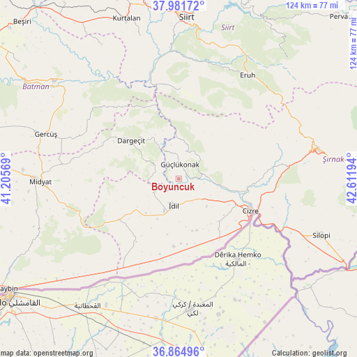
Boyuncuk GPS coordinates[2]
37° 25' 31.512" North, 41° 54' 31.716" East
| Map corner | latitude | longitude |
|---|---|---|
| Upper-left | 37.98172°, | 41.20569° |
| Center: | 37.42542°, | 41.90881° |
| Lower-right: | 36.86496°, | 42.61194° |
| Map W x H: | 124.2×124.2 km | = 77.2×77.2mi |
| max Lat: | 42.02683° ⇑76.8% North |
| Boyuncuk: | 37.42542° |
| min Lat: | ⇓23.2% South 35.9025° |
| min Long | Boyuncuk | max Long |
| 25.90902° | 41.90881° | 44.60099° |
| W 89.6%⇐ | ⇒10.4% E |
Elevation
Elevation of Boyuncuk is 751 m = 2464 ft, and this is 33.6 m = 110 ft above average elevation for this country.
| Max E: |
2682 m = 8799 ft | 47.4% |
| Boyuncuk | 751 m 2464 ft | |
| Avg. | 717.4 m = 2354 ft | |
Min E: |
0 m = 0 ft | 52.6% |
See also: Turkey elevation on elevation.city.
Geographical zone
Boyuncuk is located in North temperate zone (between Tropic of Cancer and the Arctic Circle). Distance of this Northern Tropic circle is 1555.4 km =966.5 mi to South.| Distance of | km | miles | from Boyuncuk |
|---|---|---|---|
| North Pole | 5845.7 | 3632.3 | to North |
| Arctic Circle | 3239.9 | 2013.2 | to North |
| Tropic Cancer | 1555.4 | 966.5 | to South |
| Equator | 4161.3 | 2585.7 | to South |


Nearby cities:
15 places around Boyuncuk: (largest is in red/bold)
• Akdizgin
4.8 km =3 mi,  76°
76°
• Baraniferho
4.9 km =3 mi,  357°
357°
• Barim
16.9 km =10.5 mi,  171°
171°
• Düzova
17.7 km =11 mi,  116°
116°
• Fındık
10.9 km =6.8 mi,  26°
26°
• Karabayır
17.4 km =10.8 mi,  332°
332°
• Kayaboyun
18 km =11.2 mi,  72°
72°
• Koçtepe
13.6 km =8.5 mi,  344°
344°
• Kılavuz
12.6 km =7.8 mi,  298°
298°
• Sulak
4.8 km =3 mi,  106°
106°
• Temelli
17.6 km =10.9 mi, 341°
• Tepeköy
15.8 km =9.8 mi,  208°
208°
• Tililan
12.4 km =7.7 mi, 117°
• Yarbaşı
5.4 km =3.4 mi,  225°
225°
• İdil
10.2 km =6.3 mi,  189°
189°
Sources, notices
• [Note1] Compared only with cities in Turkey existing in our database
• [Src1] Map data: © OpenStreetMap contributors (CC-BY-SA)
• [Src2] Other city data from geonames.org with taken over terms of usage.
• [Src3] Geographical zone / Annual Mean Temperature by Robert A. Rohde @ Wikipedia
