Akziyaret geodata
Akziyaret (Mardin) is a populated place; located in Turkey in Europe/Istanbul (GMT+3) time zone. With population of 520 people, there are 1299 cities with bigger population in this country. Compared to other cities in Turkey, 83.4% of cities are located further ↑North; 76.3% of cities are located further ←West and 62.3% of cities have higher elevation than Akziyaret. Note1


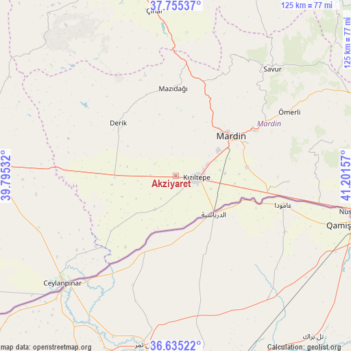
Akziyaret GPS coordinates[2]
37° 11' 50.532" North, 40° 29' 54.384" East
| Map corner | latitude | longitude |
|---|---|---|
| Upper-left | 37.75537°, | 39.79532° |
| Center: | 37.19737°, | 40.49844° |
| Lower-right: | 36.63522°, | 41.20157° |
| Map W x H: | 124.5×124.5 km | = 77.4×77.4mi |
| max Lat: | 42.02683° ⇑83.4% North |
| Akziyaret: | 37.19737° |
| min Lat: | ⇓16.6% South 35.9025° |
| min Long | Akziyaret | max Long |
| 25.90902° | 40.49844° | 44.60099° |
| W 76.3%⇐ | ⇒23.7% E |
Elevation
Elevation of Akziyaret is 468 m = 1535 ft, and this is 249.4 m = 818 ft below average elevation for this country.
| Max E: |
2682 m = 8799 ft | 62.3% |
| Avg. | 717.4 m = 2354 ft | |
| Akziyaret | 468 m = 1535 ft | |
Min E: |
0 m = 0 ft | 37.7% |
See also: Turkey elevation on elevation.city.
Geographical zone
Akziyaret is located in North temperate zone (between Tropic of Cancer and the Arctic Circle). Distance of this Northern Tropic circle is 1530 km =950.7 mi to South.| Distance of | km | miles | from Akziyaret |
|---|---|---|---|
| North Pole | 5871.1 | 3648.1 | to North |
| Arctic Circle | 3265.2 | 2028.9 | to North |
| Tropic Cancer | 1530 | 950.7 | to South |
| Equator | 4136 | 2570 | to South |


Nearby cities:
15 places around Akziyaret: (largest is in red/bold)
• Akyazı
7.1 km =4.4 mi,  123°
123°
• Ashagy-Tomik
17.1 km =10.6 mi,  71°
71°
• Doyuran
14.9 km =9.3 mi, 123°
• Elbeyli
13 km =8.1 mi,  96°
96°
• Eskin
16.1 km =10 mi,  82°
82°
• Eymirli
17 km =10.6 mi, 100°
• Eşme
13.5 km =8.4 mi,  110°
110°
• Gyundyukoru
6.2 km =3.9 mi,  177°
177°
• Karakuyu
5.8 km =3.6 mi,  136°
136°
• Kocalar
14.7 km =9.1 mi,  59°
59°
• Kyanisipi
9.6 km =6 mi, 144°
• Kızıltepe
7.1 km =4.4 mi, 98°
• Sancarlı
14 km =8.7 mi, 59°
• Yaşarköy
13.2 km =8.2 mi,  162°
162°
• Yukarı Azıklı
17.5 km =10.9 mi, 64°
Sources, notices
• [Note1] Compared only with cities in Turkey existing in our database
• [Src1] Map data: © OpenStreetMap contributors (CC-BY-SA)
• [Src2] Other city data from geonames.org with taken over terms of usage.
• [Src3] Geographical zone / Annual Mean Temperature by Robert A. Rohde @ Wikipedia
