Şalpazarı geodata
Şalpazarı (Trabzon) is a seat of a second-order administrative division; located in Turkey in Europe/Istanbul (GMT+3) time zone. With population of 10,254 people, there are 501 cities with bigger population in this country. Compared to other cities in Turkey, 87.2% of cities are located further ↓South; 69.2% of cities are located further ←West and 60% of cities have higher elevation than Şalpazarı. Note1


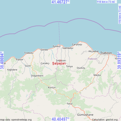
Şalpazarı GPS coordinates[2]
40° 56' 17.736" North, 39° 11' 24.216" East
| Map corner | latitude | longitude |
|---|---|---|
| Upper-left | 41.46727°, | 38.48694° |
| Center: | 40.93826°, | 39.19006° |
| Lower-right: | 40.40497°, | 39.89319° |
| Map W x H: | 118.1×118.1 km | = 73.4×73.4mi |
| max Lat: | 42.02683° ⇑12.8% North |
| Şalpazarı: | 40.93826° |
| min Lat: | ⇓87.2% South 35.9025° |
| min Long | Şalpazarı | max Long |
| 25.90902° | 39.19006° | 44.60099° |
| W 69.2%⇐ | ⇒30.8% E |
Elevation
Elevation of Şalpazarı is 506 m = 1660 ft, and this is 211.4 m = 694 ft below average elevation for this country.
| Max E: |
2682 m = 8799 ft | 60% |
| Avg. | 717.4 m = 2354 ft | |
| Şalpazarı | 506 m = 1660 ft | |
Min E: |
0 m = 0 ft | 40% |
See also: Turkey elevation on elevation.city.
Geographical zone
Şalpazarı is located in North temperate zone (between Tropic of Cancer and the Arctic Circle). Distance of this Northern Tropic circle is 1946 km =1209.2 mi to South.| Distance of | km | miles | from Şalpazarı |
|---|---|---|---|
| North Pole | 5455.2 | 3389.7 | to North |
| Arctic Circle | 2849.3 | 1770.5 | to North |
| Tropic Cancer | 1946 | 1209.2 | to South |
| Equator | 4551.9 | 2828.4 | to South |


Nearby cities:
15 places around Şalpazarı: (largest is in red/bold)
• Akçaabat
33.3 km =20.7 mi,  73°
73°
• Beşikdüzü
13.2 km =8.2 mi,  15°
15°
• Derecik
33.9 km =21.1 mi,  88°
88°
• Doğankent
27.2 km =16.9 mi,  237°
237°
• Düzköy
20.2 km =12.6 mi,  110°
110°
• Eymür
28.5 km =17.7 mi,  249°
249°
• Eynesil
14.6 km =9.1 mi,  344°
344°
• Görele
18.8 km =11.7 mi,  303°
303°
• Güce
33.3 km =20.7 mi,  261°
261°
• Kürtün
28.2 km =17.5 mi,  196°
196°
• Tirebolu
32.5 km =20.2 mi,  283°
283°
• Tonya
10 km =6.2 mi,  127°
127°
• Vakfıkebir
14 km =8.7 mi,  31°
31°
• Çanakçı
17.2 km =10.7 mi, 260°
• Çarşıbaşı
22.8 km =14.2 mi,  45°
45°
Sources, notices
• [Note1] Compared only with cities in Turkey existing in our database
• [Src1] Map data: © OpenStreetMap contributors (CC-BY-SA)
• [Src2] Other city data from geonames.org with taken over terms of usage.
• [Src3] Geographical zone / Annual Mean Temperature by Robert A. Rohde @ Wikipedia
