Eynesil geodata
Eynesil (Giresun) is a seat of a second-order administrative division; located in Turkey in Europe/Istanbul (GMT+3) time zone. With population of 13,133 people, there are 419 cities with bigger population in this country. Compared to other cities in Turkey, 91.4% of cities are located further ↓South; 68.9% of cities are located further ←West and 95.5% of cities have higher elevation than Eynesil. Note1


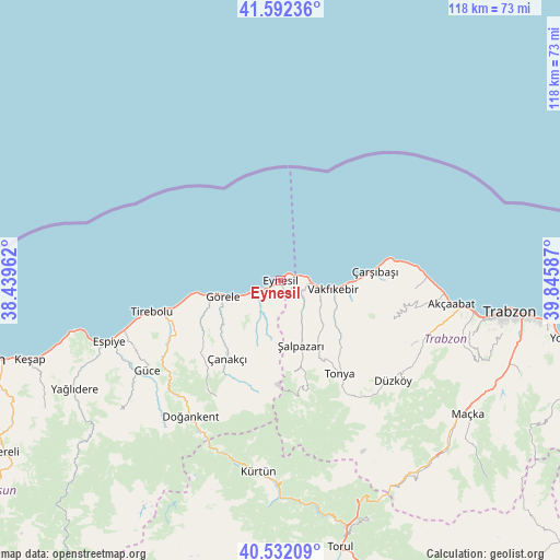
Eynesil GPS coordinates[2]
41° 3' 51.696" North, 39° 8' 33.864" East
| Map corner | latitude | longitude |
|---|---|---|
| Upper-left | 41.59236°, | 38.43962° |
| Center: | 41.06436°, | 39.14274° |
| Lower-right: | 40.53209°, | 39.84587° |
| Map W x H: | 117.9×117.9 km | = 73.3×73.3mi |
| max Lat: | 42.02683° ⇑8.6% North |
| Eynesil: | 41.06436° |
| min Lat: | ⇓91.4% South 35.9025° |
| min Long | Eynesil | max Long |
| 25.90902° | 39.14274° | 44.60099° |
| W 68.9%⇐ | ⇒31.1% E |
Elevation
Elevation of Eynesil is 15 m = 49 ft, and this is 702.4 m = 2304 ft below average elevation for this country.
| Max E: |
2682 m = 8799 ft | 95.5% |
| Avg. | 717.4 m = 2354 ft | |
| Eynesil | 15 m = 49 ft | |
Min E: |
0 m = 0 ft | 4.5% |
See also: Turkey elevation on elevation.city.
Geographical zone
Eynesil is located in North temperate zone (between Tropic of Cancer and the Arctic Circle). Distance of this Northern Tropic circle is 1960 km =1217.9 mi to South.| Distance of | km | miles | from Eynesil |
|---|---|---|---|
| North Pole | 5441.1 | 3380.9 | to North |
| Arctic Circle | 2835.2 | 1761.7 | to North |
| Tropic Cancer | 1960 | 1217.9 | to South |
| Equator | 4565.9 | 2837.1 | to South |


Nearby cities:
15 places around Eynesil: (largest is in red/bold)
• Akçaabat
36.3 km =22.6 mi,  97°
97°
• Beşikdüzü
7.7 km =4.8 mi, 100°
• Derecik
40.1 km =24.9 mi,  109°
109°
• Doğankent
34.3 km =21.3 mi,  213°
213°
• Düzköy
31.1 km =19.3 mi,  132°
132°
• Espiye
39.1 km =24.3 mi,  250°
250°
• Eymür
33 km =20.5 mi,  223°
223°
• Görele
12.3 km =7.6 mi, 252°
• Güce
34.6 km =21.5 mi,  236°
236°
• Tirebolu
28.3 km =17.6 mi,  256°
256°
• Tonya
23.3 km =14.5 mi,  149°
149°
• Vakfıkebir
11.4 km =7.1 mi, 100°
• Çanakçı
21.4 km =13.3 mi, 217°
• Çarşıbaşı
20.2 km =12.6 mi,  84°
84°
• Şalpazarı
14.6 km =9.1 mi,  164°
164°
Sources, notices
• [Note1] Compared only with cities in Turkey existing in our database
• [Src1] Map data: © OpenStreetMap contributors (CC-BY-SA)
• [Src2] Other city data from geonames.org with taken over terms of usage.
• [Src3] Geographical zone / Annual Mean Temperature by Robert A. Rohde @ Wikipedia
