Kurtkale geodata
Kurtkale (Ardahan) is a seat of a third-order administrative division; located in Turkey in Europe/Istanbul (GMT+3) time zone. In our database, there are 1323 cities with bigger population. Compared to other cities in Turkey, 95.2% of cities are located further ↓South; 97.3% of cities are located further ←West and 95.4% of cities have lower elevation than Kurtkale. Note1


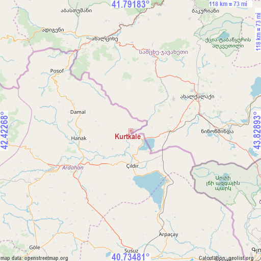
Kurtkale GPS coordinates[2]
41° 15' 55.656" North, 43° 7' 32.88" East
| Map corner | latitude | longitude |
|---|---|---|
| Upper-left | 41.79183°, | 42.42268° |
| Center: | 41.26546°, | 43.1258° |
| Lower-right: | 40.73481°, | 43.82893° |
| Map W x H: | 117.5×117.5 km | = 73×73mi |
| max Lat: | 42.02683° ⇑4.8% North |
| Kurtkale: | 41.26546° |
| min Lat: | ⇓95.2% South 35.9025° |
| min Long | Kurtkale | max Long |
| 25.90902° | 43.1258° | 44.60099° |
| W 97.3%⇐ | ⇒2.7% E |
Elevation
Elevation of Kurtkale is 1695 m = 5561 ft, and this is 977.6 m = 3207 ft above average elevation for this country.
| Max E: |
2682 m = 8799 ft | 4.6% |
| Kurtkale | 1695 m 5561 ft | |
| Avg. | 717.4 m = 2354 ft | |
Min E: |
0 m = 0 ft | 95.4% |
See also: Turkey elevation on elevation.city.
Geographical zone
Kurtkale is located in North temperate zone (between Tropic of Cancer and the Arctic Circle). Distance of this Northern Tropic circle is 1982.4 km =1231.8 mi to South.| Distance of | km | miles | from Kurtkale |
|---|---|---|---|
| North Pole | 5418.8 | 3367.1 | to North |
| Arctic Circle | 2812.9 | 1747.9 | to North |
| Tropic Cancer | 1982.4 | 1231.8 | to South |
| Equator | 4588.3 | 2851 | to South |


Nearby cities:
15 places around Kurtkale: (largest is in red/bold)
• Ardahan
39.5 km =24.5 mi,  243°
243°
• Arpaçay
49.7 km =30.9 mi,  160°
160°
• Damal
25.6 km =15.9 mi,  289°
289°
• Doğruyol
28 km =17.4 mi,  144°
144°
• Doğruyol
42.9 km =26.7 mi, 137°
• Eminbey
42.5 km =26.4 mi,  317°
317°
• Göle
68.7 km =42.7 mi,  219°
219°
• Hanak
24.1 km =15 mi,  261°
261°
• Hasköy
36.6 km =22.7 mi,  213°
213°
• Posof
42.9 km =26.7 mi,  309°
309°
• Susuz
54.1 km =33.6 mi,  179°
179°
• Veliköy
58.2 km =36.2 mi,  275°
275°
• Yalnızçam
56.9 km =35.4 mi,  246°
246°
• Zurzuna
16 km =9.9 mi, 178°
• Şavşat
64 km =39.8 mi,  267°
267°
Sources, notices
• [Note1] Compared only with cities in Turkey existing in our database
• [Src1] Map data: © OpenStreetMap contributors (CC-BY-SA)
• [Src2] Other city data from geonames.org with taken over terms of usage.
• [Src3] Geographical zone / Annual Mean Temperature by Robert A. Rohde @ Wikipedia
