Yalnızçam geodata
Yalnızçam (Ardahan) is a seat of a third-order administrative division; located in Turkey in Europe/Istanbul (GMT+3) time zone. In our database, there are 1323 cities with bigger population. Compared to other cities in Turkey, 91.5% of cities are located further ↓South; 94.2% of cities are located further ←West and 97.7% of cities have lower elevation than Yalnızçam. Note1


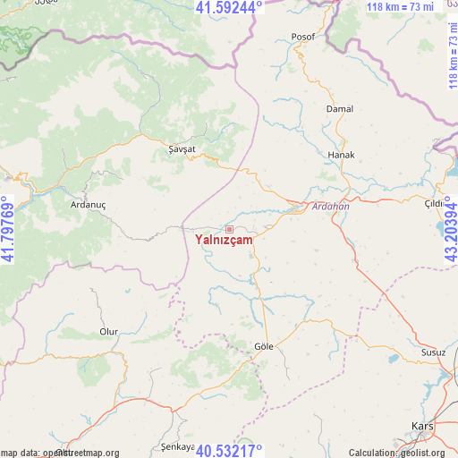
Yalnızçam GPS coordinates[2]
41° 3' 51.984" North, 42° 30' 2.916" East
| Map corner | latitude | longitude |
|---|---|---|
| Upper-left | 41.59244°, | 41.79769° |
| Center: | 41.06444°, | 42.50081° |
| Lower-right: | 40.53217°, | 43.20394° |
| Map W x H: | 117.9×117.9 km | = 73.3×73.3mi |
| max Lat: | 42.02683° ⇑8.5% North |
| Yalnızçam: | 41.06444° |
| min Lat: | ⇓91.5% South 35.9025° |
| min Long | Yalnızçam | max Long |
| 25.90902° | 42.50081° | 44.60099° |
| W 94.2%⇐ | ⇒5.8% E |
Elevation
Elevation of Yalnızçam is 1829 m = 6001 ft, and this is 1111.6 m = 3647 ft above average elevation for this country.
| Max E: |
2682 m = 8799 ft | 2.3% |
| Yalnızçam | 1829 m 6001 ft | |
| Avg. | 717.4 m = 2354 ft | |
Min E: |
0 m = 0 ft | 97.7% |
See also: Turkey elevation on elevation.city.
Geographical zone
Yalnızçam is located in North temperate zone (between Tropic of Cancer and the Arctic Circle). Distance of this Northern Tropic circle is 1960 km =1217.9 mi to South.| Distance of | km | miles | from Yalnızçam |
|---|---|---|---|
| North Pole | 5441.1 | 3380.9 | to North |
| Arctic Circle | 2835.2 | 1761.7 | to North |
| Tropic Cancer | 1960 | 1217.9 | to South |
| Equator | 4565.9 | 2837.1 | to South |


Nearby cities:
15 places around Yalnızçam: (largest is in red/bold)
• Akşar
48.4 km =30.1 mi,  196°
196°
• Ardahan
17.6 km =10.9 mi,  73°
73°
• Ardanuç
37.4 km =23.2 mi,  280°
280°
• Aşağı Irmaklar
30.3 km =18.8 mi,  295°
295°
• Damal
41.7 km =25.9 mi,  42°
42°
• Göle
32 km =19.9 mi,  163°
163°
• Hanak
34.1 km =21.2 mi,  56°
56°
• Hasköy
33.2 km =20.6 mi,  104°
104°
• Kömürlü
40.7 km =25.3 mi,  206°
206°
• Meydancık
44.3 km =27.5 mi,  330°
330°
• Olur
41.2 km =25.6 mi,  229°
229°
• Ortaköy
48 km =29.8 mi, 295°
• Veliköy
28.5 km =17.7 mi,  348°
348°
• Zurzuna
53.1 km =33 mi,  83°
83°
• Şavşat
22.8 km =14.2 mi, 329°
Sources, notices
• [Note1] Compared only with cities in Turkey existing in our database
• [Src1] Map data: © OpenStreetMap contributors (CC-BY-SA)
• [Src2] Other city data from geonames.org with taken over terms of usage.
• [Src3] Geographical zone / Annual Mean Temperature by Robert A. Rohde @ Wikipedia
