Zurzuna geodata
Zurzuna (Ardahan) is a seat of a second-order administrative division; located in Turkey in Europe/Istanbul (GMT+3) time zone. In our database, there are 1323 cities with bigger population. Compared to other cities in Turkey, 92.7% of cities are located further ↓South; 97.4% of cities are located further ←West and 98.5% of cities have lower elevation than Zurzuna. Note1


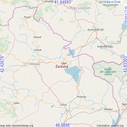
Zurzuna GPS coordinates[2]
41° 7' 17.076" North, 43° 7' 47.64" East
| Map corner | latitude | longitude |
|---|---|---|
| Upper-left | 41.64895°, | 42.42678° |
| Center: | 41.12141°, | 43.1299° |
| Lower-right: | 40.5896°, | 43.83303° |
| Map W x H: | 117.8×117.8 km | = 73.2×73.2mi |
| max Lat: | 42.02683° ⇑7.3% North |
| Zurzuna: | 41.12141° |
| min Lat: | ⇓92.7% South 35.9025° |
| min Long | Zurzuna | max Long |
| 25.90902° | 43.1299° | 44.60099° |
| W 97.4%⇐ | ⇒2.6% E |
Elevation
Elevation of Zurzuna is 1921 m = 6302 ft, and this is 1203.6 m = 3949 ft above average elevation for this country.
| Max E: |
2682 m = 8799 ft | 1.5% |
| Zurzuna | 1921 m 6302 ft | |
| Avg. | 717.4 m = 2354 ft | |
Min E: |
0 m = 0 ft | 98.5% |
See also: Turkey elevation on elevation.city.
Geographical zone
Zurzuna is located in North temperate zone (between Tropic of Cancer and the Arctic Circle). Distance of this Northern Tropic circle is 1966.4 km =1221.9 mi to South.| Distance of | km | miles | from Zurzuna |
|---|---|---|---|
| North Pole | 5434.8 | 3377 | to North |
| Arctic Circle | 2828.9 | 1757.8 | to North |
| Tropic Cancer | 1966.4 | 1221.9 | to South |
| Equator | 4572.3 | 2841.1 | to South |


Nearby cities:
15 places around Zurzuna: (largest is in red/bold)
• Akyaka
58.7 km =36.5 mi,  136°
136°
• Ardahan
35.9 km =22.3 mi,  267°
267°
• Arpaçay
34.9 km =21.7 mi,  151°
151°
• Damal
34.6 km =21.5 mi,  314°
314°
• Doğruyol
17.4 km =10.8 mi,  112°
112°
• Doğruyol
32.6 km =20.3 mi,  118°
118°
• Eminbey
55.6 km =34.5 mi,  328°
328°
• Göle
57.6 km =35.8 mi,  229°
229°
• Hanak
27.2 km =16.9 mi,  297°
297°
• Hasköy
25.2 km =15.7 mi, 234°
• Kars
58.3 km =36.2 mi,  183°
183°
• Kurtkale
16 km =9.9 mi,  358°
358°
• Posof
54.7 km =34 mi,  322°
322°
• Susuz
38.1 km =23.7 mi, 180°
• Yalnızçam
53.1 km =33 mi,  263°
263°
Sources, notices
• [Note1] Compared only with cities in Turkey existing in our database
• [Src1] Map data: © OpenStreetMap contributors (CC-BY-SA)
• [Src2] Other city data from geonames.org with taken over terms of usage.
• [Src3] Geographical zone / Annual Mean Temperature by Robert A. Rohde @ Wikipedia
