Kaynarca geodata
Kaynarca (Sakarya) is a seat of a second-order administrative division; located in Turkey in Europe/Istanbul (GMT+3) time zone. With population of 6,183 people, there are 648 cities with bigger population in this country. Compared to other cities in Turkey, 90.3% of cities are located further ↓South; 74% of cities are located further →East and 88% of cities have higher elevation than Kaynarca. Note1


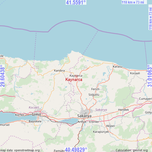
Kaynarca GPS coordinates[2]
41° 1' 50.988" North, 30° 18' 27" East
| Map corner | latitude | longitude |
|---|---|---|
| Upper-left | 41.5591°, | 29.60438° |
| Center: | 41.03083°, | 30.3075° |
| Lower-right: | 40.49829°, | 31.01063° |
| Map W x H: | 118×118 km | = 73.3×73.3mi |
| max Lat: | 42.02683° ⇑9.7% North |
| Kaynarca: | 41.03083° |
| min Lat: | ⇓90.3% South 35.9025° |
| min Long | Kaynarca | max Long |
| 25.90902° | 30.3075° | 44.60099° |
| W 26%⇐ | ⇒74% E |
Elevation
Elevation of Kaynarca is 51 m = 167 ft, and this is 666.4 m = 2186 ft below average elevation for this country.
| Max E: |
2682 m = 8799 ft | 88% |
| Avg. | 717.4 m = 2354 ft | |
| Kaynarca | 51 m = 167 ft | |
Min E: |
0 m = 0 ft | 12% |
See also: Turkey elevation on elevation.city.
Geographical zone
Kaynarca is located in North temperate zone (between Tropic of Cancer and the Arctic Circle). Distance of this Northern Tropic circle is 1956.3 km =1215.6 mi to South.| Distance of | km | miles | from Kaynarca |
|---|---|---|---|
| North Pole | 5444.9 | 3383.3 | to North |
| Arctic Circle | 2839 | 1764.1 | to North |
| Tropic Cancer | 1956.3 | 1215.6 | to South |
| Equator | 4562.2 | 2834.8 | to South |


Nearby cities:
15 places around Kaynarca: (largest is in red/bold)
• Adapazarı
29 km =18 mi,  163°
163°
• Akmeşe
22.2 km =13.8 mi,  204°
204°
• Akçaova
34 km =21.1 mi,  271°
271°
• Arifiye
36.9 km =22.9 mi,  174°
174°
• Erenler
31.5 km =19.6 mi, 166°
• Ferizli
18 km =11.2 mi,  123°
123°
• Kandıra
13.7 km =8.5 mi,  288°
288°
• Karasu
33.6 km =20.9 mi,  75°
75°
• Kaymas
12.5 km =7.8 mi, 196°
• Kazımpaşa
26.6 km =16.5 mi,  182°
182°
• Kefken
16.6 km =10.3 mi,  336°
336°
• Ortaköy
31.7 km =19.7 mi,  101°
101°
• Sapanca
37.9 km =23.5 mi,  185°
185°
• Serdivan
29.2 km =18.1 mi, 167°
• Söğütlü
19.7 km =12.2 mi,  134°
134°
Sources, notices
• [Note1] Compared only with cities in Turkey existing in our database
• [Src1] Map data: © OpenStreetMap contributors (CC-BY-SA)
• [Src2] Other city data from geonames.org with taken over terms of usage.
• [Src3] Geographical zone / Annual Mean Temperature by Robert A. Rohde @ Wikipedia
