Kandıra geodata
Kandıra (Kocaeli) is a seat of a second-order administrative division; located in Turkey in Europe/Istanbul (GMT+3) time zone. With population of 13,805 people, there are 411 cities with bigger population in this country. Compared to other cities in Turkey, 91.6% of cities are located further ↓South; 75% of cities are located further →East and 88.8% of cities have higher elevation than Kandıra. Note1


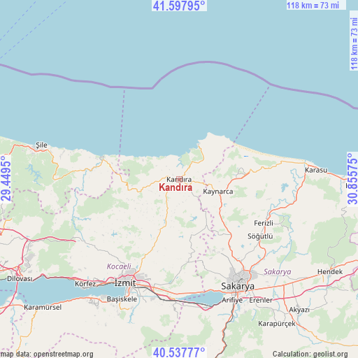
Kandıra GPS coordinates[2]
41° 4' 12" North, 30° 9' 9.432" East
| Map corner | latitude | longitude |
|---|---|---|
| Upper-left | 41.59795°, | 29.4495° |
| Center: | 41.07°, | 30.15262° |
| Lower-right: | 40.53777°, | 30.85575° |
| Map W x H: | 117.9×117.9 km | = 73.3×73.3mi |
| max Lat: | 42.02683° ⇑8.4% North |
| Kandıra: | 41.07° |
| min Lat: | ⇓91.6% South 35.9025° |
| min Long | Kandıra | max Long |
| 25.90902° | 30.15262° | 44.60099° |
| W 25%⇐ | ⇒75% E |
Elevation
Elevation of Kandıra is 45 m = 148 ft, and this is 672.4 m = 2206 ft below average elevation for this country.
| Max E: |
2682 m = 8799 ft | 88.8% |
| Avg. | 717.4 m = 2354 ft | |
| Kandıra | 45 m = 148 ft | |
Min E: |
0 m = 0 ft | 11.2% |
See also: Turkey elevation on elevation.city.
Geographical zone
Kandıra is located in North temperate zone (between Tropic of Cancer and the Arctic Circle). Distance of this Northern Tropic circle is 1960.6 km =1218.3 mi to South.| Distance of | km | miles | from Kandıra |
|---|---|---|---|
| North Pole | 5440.5 | 3380.6 | to North |
| Arctic Circle | 2834.6 | 1761.3 | to North |
| Tropic Cancer | 1960.6 | 1218.3 | to South |
| Equator | 4566.6 | 2837.6 | to South |


Nearby cities:
15 places around Kandıra: (largest is in red/bold)
• Adapazarı
38.5 km =23.9 mi,  146°
146°
• Akmeşe
24.8 km =15.4 mi,  171°
171°
• Akçaova
21.4 km =13.3 mi,  259°
259°
• Ağva
25.9 km =16.1 mi,  286°
286°
• Ferizli
31.4 km =19.5 mi,  117°
117°
• Karacaköy
33.4 km =20.8 mi, 285°
• Kaymas
18.9 km =11.7 mi, 149°
• Kaynarca
13.7 km =8.5 mi,  108°
108°
• Kazımpaşa
33.2 km =20.6 mi,  158°
158°
• Kefken
12.7 km =7.9 mi,  30°
30°
• Köseköy
38.7 km =24 mi,  198°
198°
• Serdivan
38.1 km =23.7 mi, 149°
• Söğütlü
32.6 km =20.3 mi, 124°
• Çat
31.8 km =19.8 mi,  246°
246°
• İzmit
38.8 km =24.1 mi,  208°
208°
Sources, notices
• [Note1] Compared only with cities in Turkey existing in our database
• [Src1] Map data: © OpenStreetMap contributors (CC-BY-SA)
• [Src2] Other city data from geonames.org with taken over terms of usage.
• [Src3] Geographical zone / Annual Mean Temperature by Robert A. Rohde @ Wikipedia
