Dokurcun geodata
Dokurcun (Sakarya) is a seat of a third-order administrative division; located in Turkey in Europe/Istanbul (GMT+3) time zone. In our database, there are 1323 cities with bigger population. Compared to other cities in Turkey, 78.6% of cities are located further ↓South; 71% of cities are located further →East and 69.9% of cities have higher elevation than Dokurcun. Note1


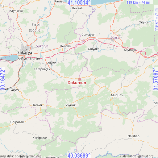
Dokurcun GPS coordinates[2]
40° 34' 23.52" North, 30° 52' 4.224" East
| Map corner | latitude | longitude |
|---|---|---|
| Upper-left | 41.10514°, | 30.16472° |
| Center: | 40.5732°, | 30.86784° |
| Lower-right: | 40.03699°, | 31.57097° |
| Map W x H: | 118.8×118.8 km | = 73.8×73.8mi |
| max Lat: | 42.02683° ⇑21.4% North |
| Dokurcun: | 40.5732° |
| min Lat: | ⇓78.6% South 35.9025° |
| min Long | Dokurcun | max Long |
| 25.90902° | 30.86784° | 44.60099° |
| W 29%⇐ | ⇒71% E |
Elevation
Elevation of Dokurcun is 304 m = 997 ft, and this is 413.4 m = 1356 ft below average elevation for this country.
| Max E: |
2682 m = 8799 ft | 69.9% |
| Avg. | 717.4 m = 2354 ft | |
| Dokurcun | 304 m = 997 ft | |
Min E: |
0 m = 0 ft | 30.1% |
See also: Turkey elevation on elevation.city.
Geographical zone
Dokurcun is located in North temperate zone (between Tropic of Cancer and the Arctic Circle). Distance of this Northern Tropic circle is 1905.4 km =1184 mi to South.| Distance of | km | miles | from Dokurcun |
|---|---|---|---|
| North Pole | 5495.7 | 3414.9 | to North |
| Arctic Circle | 2889.9 | 1795.7 | to North |
| Tropic Cancer | 1905.4 | 1184 | to South |
| Equator | 4511.3 | 2803.2 | to South |


Nearby cities:
15 places around Dokurcun: (largest is in red/bold)
• Akyazı
24.2 km =15 mi,  300°
300°
• Cumayeri
34.2 km =21.3 mi,  11°
11°
• Düzce
38.7 km =24 mi,  40°
40°
• Erenler
44.8 km =27.8 mi, 296°
• Gölyaka
25.1 km =15.6 mi,  25°
25°
• Göynük
20.4 km =12.7 mi,  199°
199°
• Gümüşova
31.1 km =19.3 mi, 11°
• Hendek
27.1 km =16.8 mi,  338°
338°
• Karadere
17.8 km =11.1 mi,  352°
352°
• Karapürçek
28.8 km =17.9 mi,  285°
285°
• Kaynaşlı
44.1 km =27.4 mi,  60°
60°
• Konuralp
43.7 km =27.2 mi, 32°
• Mudurnu
30.8 km =19.1 mi,  111°
111°
• Taraklı
37.3 km =23.2 mi,  238°
238°
• Çilimli
38.8 km =24.1 mi,  23°
23°
Sources, notices
• [Note1] Compared only with cities in Turkey existing in our database
• [Src1] Map data: © OpenStreetMap contributors (CC-BY-SA)
• [Src2] Other city data from geonames.org with taken over terms of usage.
• [Src3] Geographical zone / Annual Mean Temperature by Robert A. Rohde @ Wikipedia
