Kaynaşlı geodata
Kaynaşlı (Düzce) is a seat of a second-order administrative division; located in Turkey in Europe/Istanbul (GMT+3) time zone. In our database, there are 1323 cities with bigger population. Compared to other cities in Turkey, 82.8% of cities are located further ↓South; 69.4% of cities are located further →East and 67.7% of cities have higher elevation than Kaynaşlı. Note1


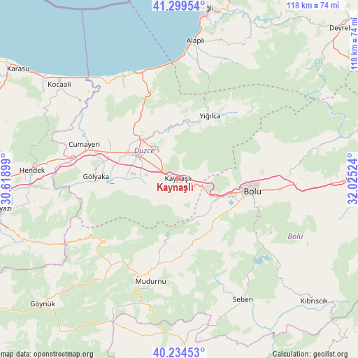
Kaynaşlı GPS coordinates[2]
40° 46' 9.012" North, 31° 19' 19.596" East
| Map corner | latitude | longitude |
|---|---|---|
| Upper-left | 41.29954°, | 30.61899° |
| Center: | 40.76917°, | 31.32211° |
| Lower-right: | 40.23453°, | 32.02524° |
| Map W x H: | 118.4×118.4 km | = 73.6×73.6mi |
| max Lat: | 42.02683° ⇑17.2% North |
| Kaynaşlı: | 40.76917° |
| min Lat: | ⇓82.8% South 35.9025° |
| min Long | Kaynaşlı | max Long |
| 25.90902° | 31.32211° | 44.60099° |
| W 30.6%⇐ | ⇒69.4% E |
Elevation
Elevation of Kaynaşlı is 362 m = 1188 ft, and this is 355.4 m = 1166 ft below average elevation for this country.
| Max E: |
2682 m = 8799 ft | 67.7% |
| Avg. | 717.4 m = 2354 ft | |
| Kaynaşlı | 362 m = 1188 ft | |
Min E: |
0 m = 0 ft | 32.3% |
See also: Turkey elevation on elevation.city.
Geographical zone
Kaynaşlı is located in North temperate zone (between Tropic of Cancer and the Arctic Circle). Distance of this Northern Tropic circle is 1927.2 km =1197.5 mi to South.| Distance of | km | miles | from Kaynaşlı |
|---|---|---|---|
| North Pole | 5474 | 3401.4 | to North |
| Arctic Circle | 2868.1 | 1782.2 | to North |
| Tropic Cancer | 1927.2 | 1197.5 | to South |
| Equator | 4533.1 | 2816.7 | to South |


Nearby cities:
15 places around Kaynaşlı: (largest is in red/bold)
• Akçakoca
39.3 km =24.4 mi,  333°
333°
• Alaplı
46.1 km =28.6 mi,  6°
6°
• Bolu
24.2 km =15 mi,  98°
98°
• Cumayeri
33.3 km =20.7 mi,  290°
290°
• Dokurcun
44.1 km =27.4 mi,  240°
240°
• Düzce
15.4 km =9.6 mi,  300°
300°
• Gölyaka
27.5 km =17.1 mi,  271°
271°
• Gümüşova
33.2 km =20.6 mi, 285°
• Hendek
48.4 km =30.1 mi, 273°
• Karadere
40.8 km =25.4 mi,  264°
264°
• Konuralp
21.2 km =13.2 mi,  315°
315°
• Mudurnu
34.3 km =21.3 mi,  196°
196°
• Seben
45.1 km =28 mi,  151°
151°
• Yığılca
23.5 km =14.6 mi,  25°
25°
• Çilimli
26.8 km =16.7 mi, 301°
Sources, notices
• [Note1] Compared only with cities in Turkey existing in our database
• [Src1] Map data: © OpenStreetMap contributors (CC-BY-SA)
• [Src2] Other city data from geonames.org with taken over terms of usage.
• [Src3] Geographical zone / Annual Mean Temperature by Robert A. Rohde @ Wikipedia
