Kisiwani geodata
Kisiwani (Kilimanjaro) is a populated place; located in Tanzania in Africa/Dar_es_Salaam (GMT+3) time zone. With population of 7,126 people, there are 262 cities with bigger population in this country. Compared to other cities in Tanzania, 69.2% of cities are located further ↓South; 72.7% of cities are located further ←West and 66.1% of cities have higher elevation than Kisiwani. Note1


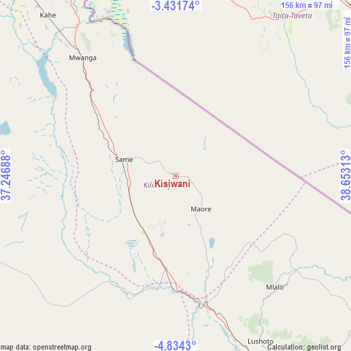
Kisiwani GPS coordinates[2]
4° 7' 59.988" South, 37° 57' 0" East
| Map corner | latitude | longitude |
|---|---|---|
| Upper-left | -3.43174°, | 37.24688° |
| Center: | -4.13333°, | 37.95° |
| Lower-right: | -4.8343°, | 38.65313° |
| Map W x H: | 156×156 km | = 96.9×96.9mi |
| max Lat: | -1.14389° ⇑30.8% North |
| Kisiwani: | -4.13333° |
| min Lat: | ⇓69.2% South -11.36667° |
| min Long | Kisiwani | max Long |
| 29.62667° | 37.95° | 40.33333° |
| W 72.7%⇐ | ⇒27.3% E |
Elevation
Elevation of Kisiwani is 677 m = 2221 ft, and this is 265.8 m = 872 ft below average elevation for this country.
| Max E: |
2377 m = 7799 ft | 66.1% |
| Avg. | 942.8 m = 3093 ft | |
| Kisiwani | 677 m = 2221 ft | |
Min E: |
0 m = 0 ft | 33.9% |
See also: Tanzania elevation on elevation.city.
Geographical zone
Kisiwani is located in South Torrid zone (between Equator and Tropic of Capricorn). Distance of Equator is 459.6 km =285.6 mi to North.| Distance of | km | miles | from Kisiwani |
|---|---|---|---|
| Equator | 459.6 | 285.6 | to North |
| Tropic Capricorn | 2146.3 | 1333.6 | to South |
| Antarctic Circle | 6941.6 | 4313.3 | to South |
| South Pole | 9547.5 | 5932.5 | to South |


Nearby cities:
15 places around Kisiwani: (largest is in red/bold)
• Hedaru
41.1 km =25.5 mi,  187°
187°
• Kihurio
39.3 km =24.4 mi,  160°
160°
• Kirya
57.1 km =35.5 mi,  294°
294°
• Kwakoa
48.3 km =30 mi,  327°
327°
• Lembeni
53.7 km =33.4 mi,  316°
316°
• Lushoto
81.2 km =50.5 mi,  152°
152°
• Makanya
29 km =18 mi,  206°
206°
• Makuyuni
68.8 km =42.8 mi,  166°
166°
• Matui
81.2 km =50.5 mi, 155°
• Mazinde
79.8 km =49.6 mi, 158°
• Mwanga
79.1 km =49.2 mi, 159°
• Mwembe
11.2 km =7 mi,  260°
260°
• Ndungu
28.2 km =17.5 mi, 156°
• Same
25.1 km =15.6 mi, 287°
• Soni
92.1 km =57.2 mi, 149°
Sources, notices
• [Note1] Compared only with cities in Tanzania existing in our database
• [Src1] Map data: © OpenStreetMap contributors (CC-BY-SA)
• [Src2] Other city data from geonames.org with taken over terms of usage.
• [Src3] Geographical zone / Annual Mean Temperature by Robert A. Rohde @ Wikipedia
