Lembeni geodata
Lembeni (Kilimanjaro) is a populated place; located in Tanzania in Africa/Dar_es_Salaam (GMT+3) time zone. With population of 16,008 people, there are 177 cities with bigger population in this country. Compared to other cities in Tanzania, 72.7% of cities are located further ↓South; 69.6% of cities are located further ←West and 59.1% of cities have higher elevation than Lembeni. Note1


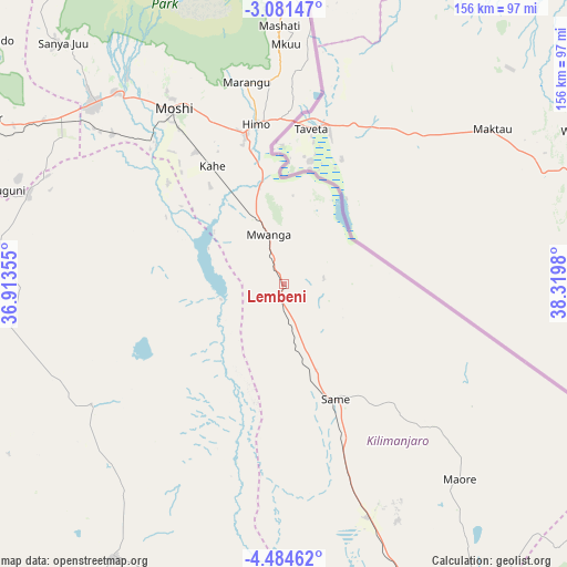
Lembeni GPS coordinates[2]
3° 46' 59.988" South, 37° 37' 0.012" East
| Map corner | latitude | longitude |
|---|---|---|
| Upper-left | -3.08147°, | 36.91355° |
| Center: | -3.78333°, | 37.61667° |
| Lower-right: | -4.48462°, | 38.3198° |
| Map W x H: | 156×156 km | = 96.9×96.9mi |
| max Lat: | -1.14389° ⇑27.3% North |
| Lembeni: | -3.78333° |
| min Lat: | ⇓72.7% South -11.36667° |
| min Long | Lembeni | max Long |
| 29.62667° | 37.61667° | 40.33333° |
| W 69.6%⇐ | ⇒30.4% E |
Elevation
Elevation of Lembeni is 979 m = 3212 ft, and this is 36.2 m = 119 ft above average elevation for this country.
| Max E: |
2377 m = 7799 ft | 59.1% |
| Lembeni | 979 m 3212 ft | |
| Avg. | 942.8 m = 3093 ft | |
Min E: |
0 m = 0 ft | 40.9% |
See also: Tanzania elevation on elevation.city.
Geographical zone
Lembeni is located in South Torrid zone (between Equator and Tropic of Capricorn). Distance of Equator is 420.7 km =261.4 mi to North.| Distance of | km | miles | from Lembeni |
|---|---|---|---|
| Equator | 420.7 | 261.4 | to North |
| Tropic Capricorn | 2185.3 | 1357.9 | to South |
| Antarctic Circle | 6980.5 | 4337.5 | to South |
| South Pole | 9586.4 | 5956.7 | to South |


Nearby cities:
15 places around Lembeni: (largest is in red/bold)
• Hedaru
85.7 km =53.3 mi,  158°
158°
• Kihurio
90.9 km =56.5 mi,  146°
146°
• Kingori
89.6 km =55.7 mi,  308°
308°
• Kirya
20.9 km =13 mi,  224°
224°
• Kisiwani
53.7 km =33.4 mi,  136°
136°
• Kwakoa
11.2 km =7 mi,  80°
80°
• Makanya
69.2 km =43 mi, 159°
• Mbuguni
77.8 km =48.3 mi,  288°
288°
• Merelani
74.9 km =46.5 mi, 289°
• Moshi
57.5 km =35.7 mi,  326°
326°
• Mwembe
48.3 km =30 mi, 147°
• Naberera
88.8 km =55.2 mi,  238°
238°
• Ndungu
80.7 km =50.1 mi, 143°
• Same
34.1 km =21.2 mi, 157°
• Usa River
96.9 km =60.2 mi,  298°
298°
Sources, notices
• [Note1] Compared only with cities in Tanzania existing in our database
• [Src1] Map data: © OpenStreetMap contributors (CC-BY-SA)
• [Src2] Other city data from geonames.org with taken over terms of usage.
• [Src3] Geographical zone / Annual Mean Temperature by Robert A. Rohde @ Wikipedia
