Namikupa geodata
Namikupa (Mtwara) is a populated place; located in Tanzania in Africa/Dar_es_Salaam (GMT+3) time zone. With population of 11,733 people, there are 220 cities with bigger population in this country. Compared to other cities in Tanzania, 96.2% of cities are located further ↑North; 95.1% of cities are located further ←West and 81.5% of cities have higher elevation than Namikupa. Note1


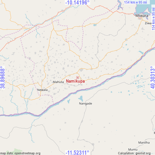
Namikupa GPS coordinates[2]
10° 49' 59.988" South, 39° 36' 0" East
| Map corner | latitude | longitude |
|---|---|---|
| Upper-left | -10.14196°, | 38.89688° |
| Center: | -10.83333°, | 39.6° |
| Lower-right: | -11.52311°, | 40.30313° |
| Map W x H: | 153.6×153.6 km | = 95.4×95.4mi |
| max Lat: | -1.14389° ⇑96.2% North |
| Namikupa: | -10.83333° |
| min Lat: | ⇓3.8% South -11.36667° |
| min Long | Namikupa | max Long |
| 29.62667° | 39.6° | 40.33333° |
| W 95.1%⇐ | ⇒4.9% E |
Elevation
Elevation of Namikupa is 276 m = 906 ft, and this is 666.8 m = 2188 ft below average elevation for this country.
| Max E: |
2377 m = 7799 ft | 81.5% |
| Avg. | 942.8 m = 3093 ft | |
| Namikupa | 276 m = 906 ft | |
Min E: |
0 m = 0 ft | 18.5% |
See also: Tanzania elevation on elevation.city.
Geographical zone
Namikupa is located in South Torrid zone (between Equator and Tropic of Capricorn). Distance of Equator is 1204.6 km =748.5 mi to North.| Distance of | km | miles | from Namikupa |
|---|---|---|---|
| Equator | 1204.6 | 748.5 | to North |
| Tropic Capricorn | 1401.4 | 870.8 | to South |
| Antarctic Circle | 6196.6 | 3850.4 | to South |
| South Pole | 8802.5 | 5469.6 | to South |


Nearby cities:
15 places around Namikupa: (largest is in red/bold)
• Chiungutwa
67.6 km =42 mi,  265°
265°
• Kitama
19.5 km =12.1 mi,  48°
48°
• Kitangari
35.6 km =22.1 mi,  304°
304°
• Luchingu
30 km =18.6 mi,  255°
255°
• Lulindi
51 km =31.7 mi, 272°
• Mahuta
16.8 km =10.4 mi, 257°
• Mingoyo
81 km =50.3 mi,  1°
1°
• Mtama
64.6 km =40.1 mi,  336°
336°
• Namalenga
56.1 km =34.9 mi, 256°
• Nanganga
70.2 km =43.6 mi,  315°
315°
• Nanhyanga
6.6 km =4.1 mi, 304°
• Nanyamba
30.5 km =19 mi,  56°
56°
• Newala Kisimani
36.9 km =22.9 mi,  249°
249°
• Nyangao
65.5 km =40.7 mi,  328°
328°
• Tandahimba
10 km =6.2 mi,  21°
21°
Sources, notices
• [Note1] Compared only with cities in Tanzania existing in our database
• [Src1] Map data: © OpenStreetMap contributors (CC-BY-SA)
• [Src2] Other city data from geonames.org with taken over terms of usage.
• [Src3] Geographical zone / Annual Mean Temperature by Robert A. Rohde @ Wikipedia
