Mtama geodata
Mtama (Lindi) is a populated place; located in Tanzania in Africa/Dar_es_Salaam (GMT+3) time zone. With population of 11,928 people, there are 213 cities with bigger population in this country. Compared to other cities in Tanzania, 89.9% of cities are located further ↑North; 92.7% of cities are located further ←West and 87.4% of cities have higher elevation than Mtama. Note1


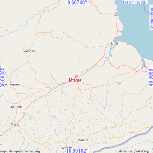
Mtama GPS coordinates[2]
10° 18' 0" South, 39° 22' 0.012" East
| Map corner | latitude | longitude |
|---|---|---|
| Upper-left | -9.60746°, | 38.66355° |
| Center: | -10.3°, | 39.36667° |
| Lower-right: | -10.99102°, | 40.0698° |
| Map W x H: | 153.8×153.8 km | = 95.6×95.6mi |
| max Lat: | -1.14389° ⇑89.9% North |
| Mtama: | -10.3° |
| min Lat: | ⇓10.1% South -11.36667° |
| min Long | Mtama | max Long |
| 29.62667° | 39.36667° | 40.33333° |
| W 92.7%⇐ | ⇒7.3% E |
Elevation
Elevation of Mtama is 136 m = 446 ft, and this is 806.8 m = 2647 ft below average elevation for this country.
| Max E: |
2377 m = 7799 ft | 87.4% |
| Avg. | 942.8 m = 3093 ft | |
| Mtama | 136 m = 446 ft | |
Min E: |
0 m = 0 ft | 12.6% |
See also: Tanzania elevation on elevation.city.
Geographical zone
Mtama is located in South Torrid zone (between Equator and Tropic of Capricorn). Distance of Equator is 1145.3 km =711.7 mi to North.| Distance of | km | miles | from Mtama |
|---|---|---|---|
| Equator | 1145.3 | 711.7 | to North |
| Tropic Capricorn | 1460.7 | 907.6 | to South |
| Antarctic Circle | 6255.9 | 3887.2 | to South |
| South Pole | 8861.8 | 5506.5 | to South |


Nearby cities:
15 places around Mtama: (largest is in red/bold)
• Kitama
61.3 km =38.1 mi,  139°
139°
• Kitangari
39.1 km =24.3 mi,  185°
185°
• Lindi
51 km =31.7 mi,  48°
48°
• Lulindi
62.9 km =39.1 mi,  203°
203°
• Mahuta
63.7 km =39.6 mi,  171°
171°
• Mbekenyera
53.6 km =33.3 mi,  308°
308°
• Mingoyo
35.1 km =21.8 mi, 51°
• Nachingwea
66.6 km =41.4 mi,  263°
263°
• Namikupa
64.6 km =40.1 mi,  156°
156°
• Nanganga
25.4 km =15.8 mi,  248°
248°
• Nanhyanga
59.1 km =36.7 mi, 160°
• Nanyamba
66.5 km =41.3 mi,  129°
129°
• Nyangao
9.8 km =6.1 mi, 247°
• Ruangwa
54.1 km =33.6 mi,  298°
298°
• Tandahimba
57.9 km =36 mi,  149°
149°
Sources, notices
• [Note1] Compared only with cities in Tanzania existing in our database
• [Src1] Map data: © OpenStreetMap contributors (CC-BY-SA)
• [Src2] Other city data from geonames.org with taken over terms of usage.
• [Src3] Geographical zone / Annual Mean Temperature by Robert A. Rohde @ Wikipedia
