Pervomayskoye geodata
Pervomayskoye (Republic of Crimea) is a seat of a third-order administrative division; located in Ukraine in Europe/Simferopol (GMT+3) time zone. With population of 2,880 people, there are 982 cities with bigger population in this country. Compared to other cities in Ukraine, 89.1% of cities are located further ↑North; 82.2% of cities are located further ←West and 62.9% of cities have lower elevation than Pervomayskoye. Note1
Administrative division(s):
- Level 1: Republic of Crimea
- Level 2: Kirovske Raion
- Level 3: Pervomayskoye sel'skoye poselenye


Pervomayskoye GPS coordinates[2]
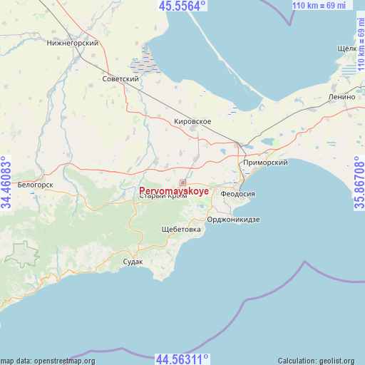
45° 3' 42.876" North, 35° 9' 50.22" East
| Map corner | latitude | longitude |
|---|---|---|
| Upper-left | 45.5564°, | 34.46083° |
| Center: | 45.06191°, | 35.16395° |
| Lower-right: | 44.56311°, | 35.86708° |
| Map W x H: | 110.4×110.4 km | = 68.6×68.6mi |
| max Lat: | 52.18903° ⇑89.1% North |
| Pervomayskoye: | 45.06191° |
| min Lat: | ⇓10.9% South 44.39214° |
| min Long | Pervomayskoye | max Long |
| 22.20555° | 35.16395° | 40.13222° |
| W 82.2%⇐ | ⇒17.8% E |
Elevation
Elevation of Pervomayskoye is 179 m = 587 ft, and this is 23.2 m = 76 ft above average elevation for this country.
| Max E: |
886 m = 2907 ft | 37.1% |
| Pervomayskoye | 179 m 587 ft | |
| Avg. | 155.8 m = 511 ft | |
Min E: |
-3 m = -10 ft | 62.9% |
See also: Ukraine elevation on elevation.city.
Geographical zone
Pervomayskoye is located in North temperate zone (between Tropic of Cancer and the Arctic Circle). Distance of this North polar circle is 2390.8 km =1485.6 mi to North.| Distance of | km | miles | from Pervomayskoye |
|---|---|---|---|
| North Pole | 4996.6 | 3104.7 | to North |
| Arctic Circle | 2390.8 | 1485.6 | to North |
| Tropic Cancer | 2404.5 | 1494.1 | to South |
| Equator | 5010.4 | 3113.3 | to South |


Nearby cities:
15 places around Pervomayskoye: (largest is in red/bold)
• Abrikosovka
7.1 km =4.4 mi,  315°
315°
• Babenkovo
4.7 km =2.9 mi,  325°
325°
• Blizhneye
13.1 km =8.1 mi,  92°
92°
• Izyumovka
2.9 km =1.8 mi,  227°
227°
• Kholodovka
13.5 km =8.4 mi,  265°
265°
• Koktebel
12.9 km =8 mi,  149°
149°
• Nasypnoe
10.3 km =6.4 mi,  95°
95°
• Novopokrovka
13.4 km =8.3 mi,  31°
31°
• Partizany
9.1 km =5.7 mi,  355°
355°
• Privetnoye
10.4 km =6.5 mi,  308°
308°
• Shchebetovka
13.8 km =8.6 mi,  181°
181°
• Solnechnoye
14.3 km =8.9 mi, 96°
• Stary Krym
6.8 km =4.2 mi,  237°
237°
• Zhuravki
8.2 km =5.1 mi, 29°
• Zolotoye Pole
15.4 km =9.6 mi,  298°
298°
Sources, notices
• [Note1] Compared only with cities in Ukraine existing in our database
• [Src1] Map data: © OpenStreetMap contributors (CC-BY-SA)
• [Src2] Other city data from geonames.org with taken over terms of usage.
• [Src3] Geographical zone / Annual Mean Temperature by Robert A. Rohde @ Wikipedia
