Abrikosovka geodata
Abrikosovka (Republic of Crimea) is a seat of a third-order administrative division; located in Ukraine in Europe/Simferopol (GMT+3) time zone. With population of 1,079 people, there are 1342 cities with bigger population in this country. Compared to other cities in Ukraine, 88.2% of cities are located further ↑North; 81.3% of cities are located further ←West and 51.5% of cities have lower elevation than Abrikosovka. Note1
Administrative division(s):
- Level 1: Republic of Crimea
- Level 2: Kirovske Raion
- Level 3: Abrikosovskoye sel'skoye poselenye


Abrikosovka GPS coordinates[2]
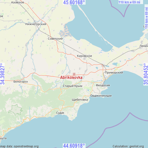
45° 6' 27.324" North, 35° 6' 5.004" East
| Map corner | latitude | longitude |
|---|---|---|
| Upper-left | 45.60168°, | 34.39827° |
| Center: | 45.10759°, | 35.10139° |
| Lower-right: | 44.60918°, | 35.80452° |
| Map W x H: | 110.4×110.4 km | = 68.6×68.6mi |
| max Lat: | 52.18903° ⇑88.2% North |
| Abrikosovka: | 45.10759° |
| min Lat: | ⇓11.8% South 44.39214° |
| min Long | Abrikosovka | max Long |
| 22.20555° | 35.10139° | 40.13222° |
| W 81.3%⇐ | ⇒18.7% E |
Elevation
Elevation of Abrikosovka is 140 m = 459 ft, and this is 15.8 m = 52 ft below average elevation for this country.
| Max E: |
886 m = 2907 ft | 48.5% |
| Avg. | 155.8 m = 511 ft | |
| Abrikosovka | 140 m = 459 ft | |
Min E: |
-3 m = -10 ft | 51.5% |
See also: Ukraine elevation on elevation.city.
Geographical zone
Abrikosovka is located in North temperate zone (between Tropic of Cancer and the Arctic Circle). Distance of this North polar circle is 2385.7 km =1482.4 mi to North.| Distance of | km | miles | from Abrikosovka |
|---|---|---|---|
| North Pole | 4991.6 | 3101.6 | to North |
| Arctic Circle | 2385.7 | 1482.4 | to North |
| Tropic Cancer | 2409.6 | 1497.3 | to South |
| Equator | 5015.5 | 3116.5 | to South |


Nearby cities:
15 places around Abrikosovka: (largest is in red/bold)
• Babenkovo
2.5 km =1.6 mi,  117°
117°
• Izyumovka
7.6 km =4.7 mi,  158°
158°
• Kholodovka
10.5 km =6.5 mi,  234°
234°
• L’govskoye
11.3 km =7 mi,  264°
264°
• Novopokrovka
13.5 km =8.4 mi,  61°
61°
• Partizany
5.8 km =3.6 mi,  46°
46°
• Pervomayskoye
7.1 km =4.4 mi,  135°
135°
• Privetnoye
3.5 km =2.2 mi,  292°
292°
• Stary Krym
8.8 km =5.5 mi,  184°
184°
• Trudolyubovka
12.8 km =8 mi,  18°
18°
• Vostochnoye
13.7 km =8.5 mi,  334°
334°
• Vozrozhdeniye
9.1 km =5.7 mi,  323°
323°
• Yarkoye Pole
13.3 km =8.3 mi,  34°
34°
• Zhuravki
9.2 km =5.7 mi,  76°
76°
• Zolotoye Pole
8.9 km =5.5 mi,  284°
284°
Sources, notices
• [Note1] Compared only with cities in Ukraine existing in our database
• [Src1] Map data: © OpenStreetMap contributors (CC-BY-SA)
• [Src2] Other city data from geonames.org with taken over terms of usage.
• [Src3] Geographical zone / Annual Mean Temperature by Robert A. Rohde @ Wikipedia
