Yasnohorodka geodata
Yasnohorodka (Kyiv) is a populated place; located in Ukraine in Europe/Kiev (GMT+3) time zone. With population of 739 people, there are 1515 cities with bigger population in this country. Compared to other cities in Ukraine, 88.8% of cities are located further ↓South; 67.6% of cities are located further →East and 61.4% of cities have lower elevation than Yasnohorodka. Note1


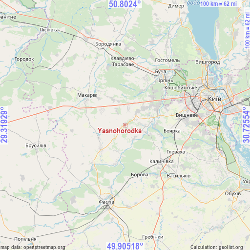
Yasnohorodka GPS coordinates[2]
50° 21' 21.276" North, 30° 1' 20.676" East
| Map corner | latitude | longitude |
|---|---|---|
| Upper-left | 50.8024°, | 29.31929° |
| Center: | 50.35591°, | 30.02241° |
| Lower-right: | 49.90518°, | 30.72554° |
| Map W x H: | 99.8×99.8 km | = 62×62mi |
| max Lat: | 52.18903° ⇑11.2% North |
| Yasnohorodka: | 50.35591° |
| min Lat: | ⇓88.8% South 44.39214° |
| min Long | Yasnohorodka | max Long |
| 22.20555° | 30.02241° | 40.13222° |
| W 32.4%⇐ | ⇒67.6% E |
Elevation
Elevation of Yasnohorodka is 173 m = 568 ft, and this is 17.2 m = 56 ft above average elevation for this country.
| Max E: |
886 m = 2907 ft | 38.6% |
| Yasnohorodka | 173 m 568 ft | |
| Avg. | 155.8 m = 511 ft | |
Min E: |
-3 m = -10 ft | 61.4% |
See also: Ukraine elevation on elevation.city.
Geographical zone
Yasnohorodka is located in North temperate zone (between Tropic of Cancer and the Arctic Circle). Distance of this North polar circle is 1802.1 km =1119.8 mi to North.| Distance of | km | miles | from Yasnohorodka |
|---|---|---|---|
| North Pole | 4408 | 2739 | to North |
| Arctic Circle | 1802.1 | 1119.8 | to North |
| Tropic Cancer | 2993.1 | 1859.8 | to South |
| Equator | 5599.1 | 3479.1 | to South |


Nearby cities:
15 places around Yasnohorodka: (largest is in red/bold)
• Bobrytsya
11.8 km =7.3 mi,  93°
93°
• Borova
20.8 km =12.9 mi,  163°
163°
• Boyarka
19.9 km =12.4 mi,  101°
101°
• Bucha
24.8 km =15.4 mi,  32°
32°
• Hlevakha
23.5 km =14.6 mi,  112°
112°
• Irpin
24.5 km =15.2 mi,  41°
41°
• Klavdiyevo-Tarasove
25.4 km =15.8 mi,  358°
358°
• Kotsyubyns’ke
26.3 km =16.3 mi,  55°
55°
• Kriukivschina
24.6 km =15.3 mi, 85°
• Makariv
19.2 km =11.9 mi,  308°
308°
• Motovylivka
22.3 km =13.9 mi,  170°
170°
• Sofiyivska Borschagivka
25.2 km =15.7 mi,  76°
76°
• Vasylkiv
27.9 km =17.3 mi,  132°
132°
• Vorzel’
22.9 km =14.2 mi,  23°
23°
• Vyshneve
25 km =15.5 mi, 81°
Sources, notices
• [Note1] Compared only with cities in Ukraine existing in our database
• [Src1] Map data: © OpenStreetMap contributors (CC-BY-SA)
• [Src2] Other city data from geonames.org with taken over terms of usage.
• [Src3] Geographical zone / Annual Mean Temperature by Robert A. Rohde @ Wikipedia
