Sobolivka geodata
Sobolivka (Vinnyts'ka) is a populated place; located in Ukraine in Europe/Kiev (GMT+3) time zone. With population of 3,605 people, there are 816 cities with bigger population in this country. Compared to other cities in Ukraine, 71.5% of cities are located further ↓South; 74.1% of cities are located further →East and 79.9% of cities have lower elevation than Sobolivka. Note1


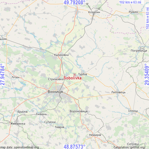
Sobolivka GPS coordinates[2]
49° 20' 9.744" North, 28° 39' 3.456" East
| Map corner | latitude | longitude |
|---|---|---|
| Upper-left | 49.79208°, | 27.94784° |
| Center: | 49.33604°, | 28.65096° |
| Lower-right: | 48.87573°, | 29.35409° |
| Map W x H: | 101.9×101.9 km | = 63.3×63.3mi |
| max Lat: | 52.18903° ⇑28.5% North |
| Sobolivka: | 49.33604° |
| min Lat: | ⇓71.5% South 44.39214° |
| min Long | Sobolivka | max Long |
| 22.20555° | 28.65096° | 40.13222° |
| W 25.9%⇐ | ⇒74.1% E |
Elevation
Elevation of Sobolivka is 246 m = 807 ft, and this is 90.2 m = 296 ft above average elevation for this country.
| Max E: |
886 m = 2907 ft | 20.1% |
| Sobolivka | 246 m 807 ft | |
| Avg. | 155.8 m = 511 ft | |
Min E: |
-3 m = -10 ft | 79.9% |
See also: Ukraine elevation on elevation.city.
Geographical zone
Sobolivka is located in North temperate zone (between Tropic of Cancer and the Arctic Circle). Distance of this North polar circle is 1915.5 km =1190.2 mi to North.| Distance of | km | miles | from Sobolivka |
|---|---|---|---|
| North Pole | 4521.4 | 2809.5 | to North |
| Arctic Circle | 1915.5 | 1190.2 | to North |
| Tropic Cancer | 2879.7 | 1789.4 | to South |
| Equator | 5485.7 | 3408.7 | to South |


Nearby cities:
15 places around Sobolivka: (largest is in red/bold)
• Brailiv
42.8 km =26.6 mi,  233°
233°
• Illintsi
48.5 km =30.1 mi,  121°
121°
• Kalynivka
15.9 km =9.9 mi,  325°
325°
• Kozyatyn
44.1 km =27.4 mi,  17°
17°
• Lityn
41.3 km =25.7 mi,  268°
268°
• Lypovets
31.6 km =19.6 mi,  111°
111°
• Nemyriv
42.8 km =26.6 mi,  161°
161°
• Nova Pryluka
5.6 km =3.5 mi,  39°
39°
• Pavlivka
18.1 km =11.2 mi,  310°
310°
• Pohrebyshche
47.4 km =29.5 mi,  69°
69°
• Sutysky
36.8 km =22.9 mi,  207°
207°
• Turbiv
5.3 km =3.3 mi,  75°
75°
• Tyvriv
37.3 km =23.2 mi,  196°
196°
• Vinnytsia
16.8 km =10.4 mi, 227°
• Voronovytsya
25.3 km =15.7 mi,  175°
175°
Sources, notices
• [Note1] Compared only with cities in Ukraine existing in our database
• [Src1] Map data: © OpenStreetMap contributors (CC-BY-SA)
• [Src2] Other city data from geonames.org with taken over terms of usage.
• [Src3] Geographical zone / Annual Mean Temperature by Robert A. Rohde @ Wikipedia
